Day 6: Álggavágge – Niejdariehpvágge – Sarvesvágge
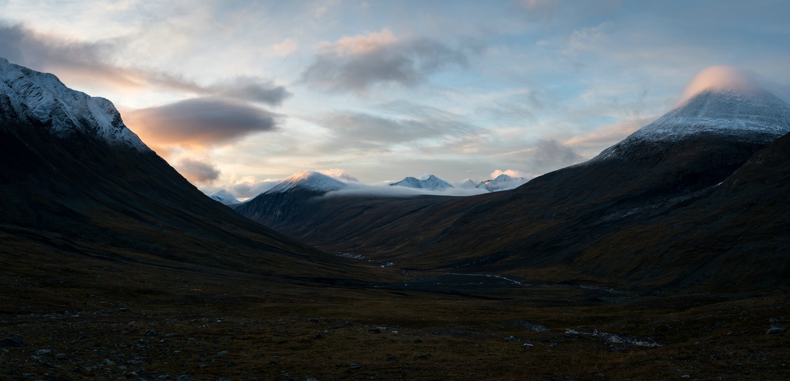
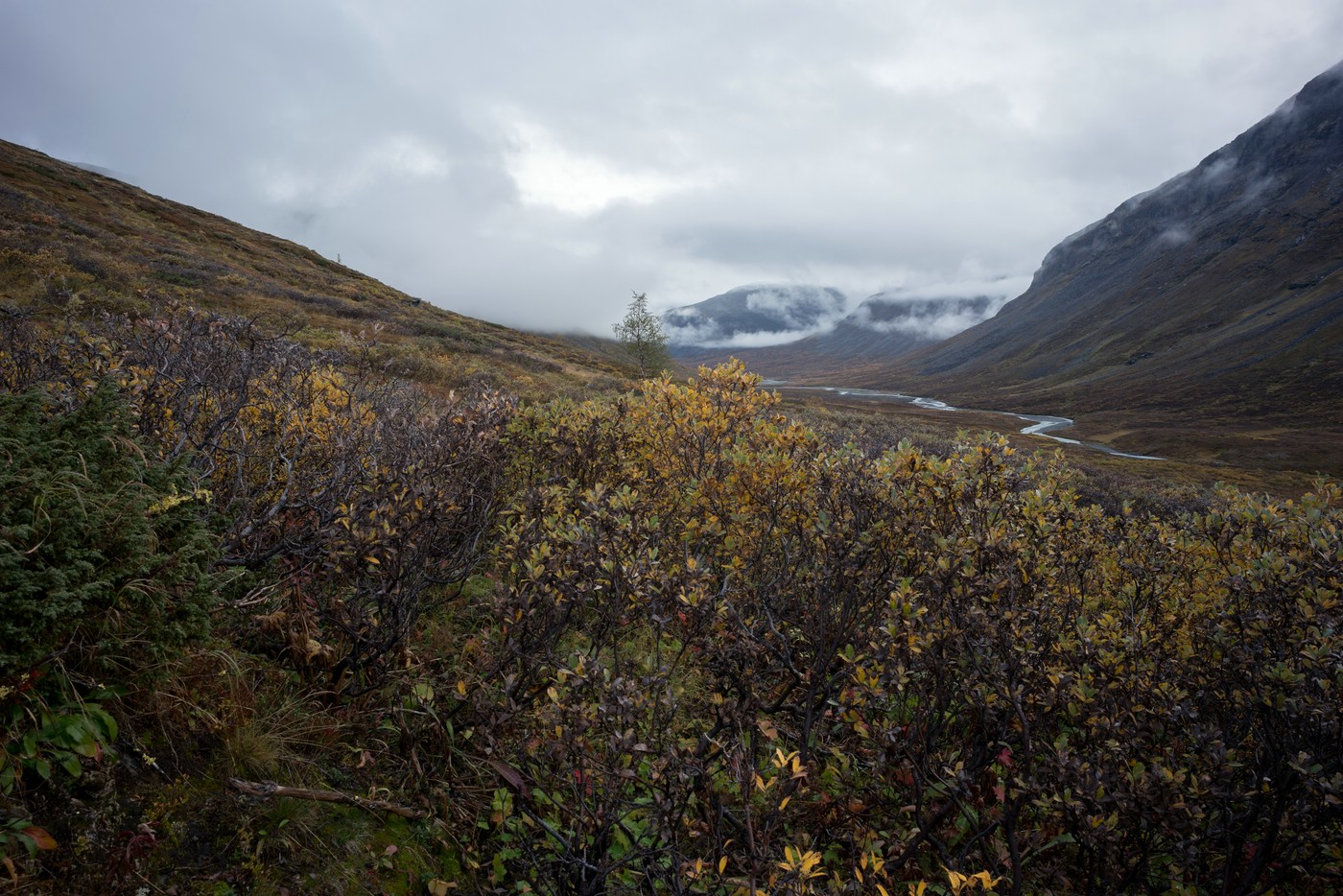
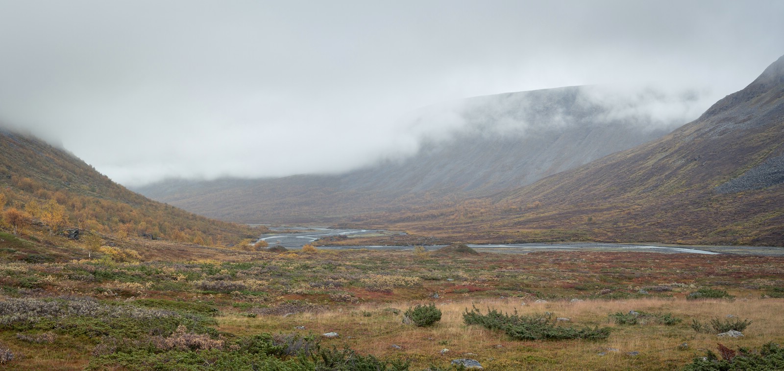
The night is uneventful. When I wake up, the weather is the same as the evening before. The sky is mostly overcast. I have breakfast and then take a few photos at the creek. The cloud movement around the mountain peaks is quite interesting. I try to capture this with a long exposure:
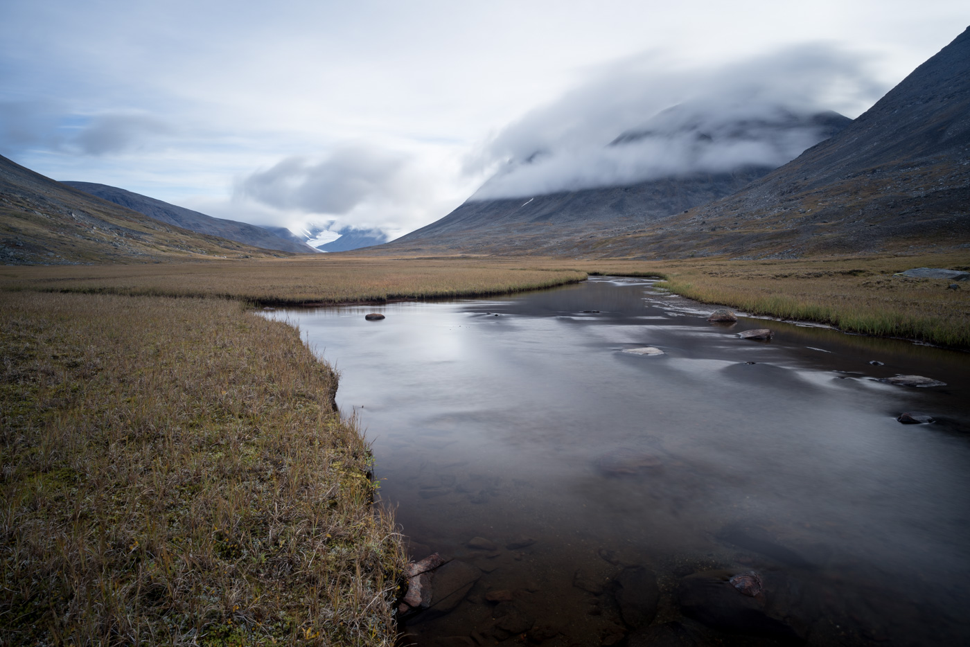
It is not yet possible to look around the “bend” in the valley.
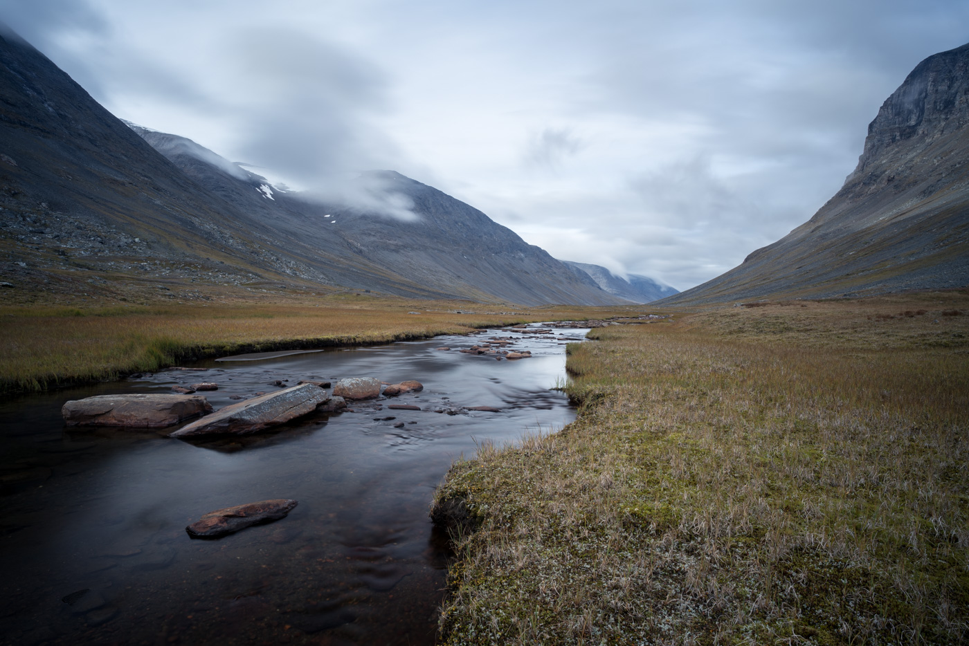
I pack up my things which is now routine and thus quick. I’m glad it’s dry. I cross over to the southern bank of the stream, which is possible without taking off my shoes. Then I continue west along the valley.
In the beginning the terrain makes for pleasant walking. From time to time I encounter small streams.
Later, however, the valley floor is more and more covered by brush and bushes, some of them as tall as a person. As if that weren’t enough, the gaps between are of swampy consistence. This delays my progress, and I don’t feel like taking photos either. I console myself with the fact that I know from my hike five years ago that it isn’t much better on the other side of the stream either ;-).
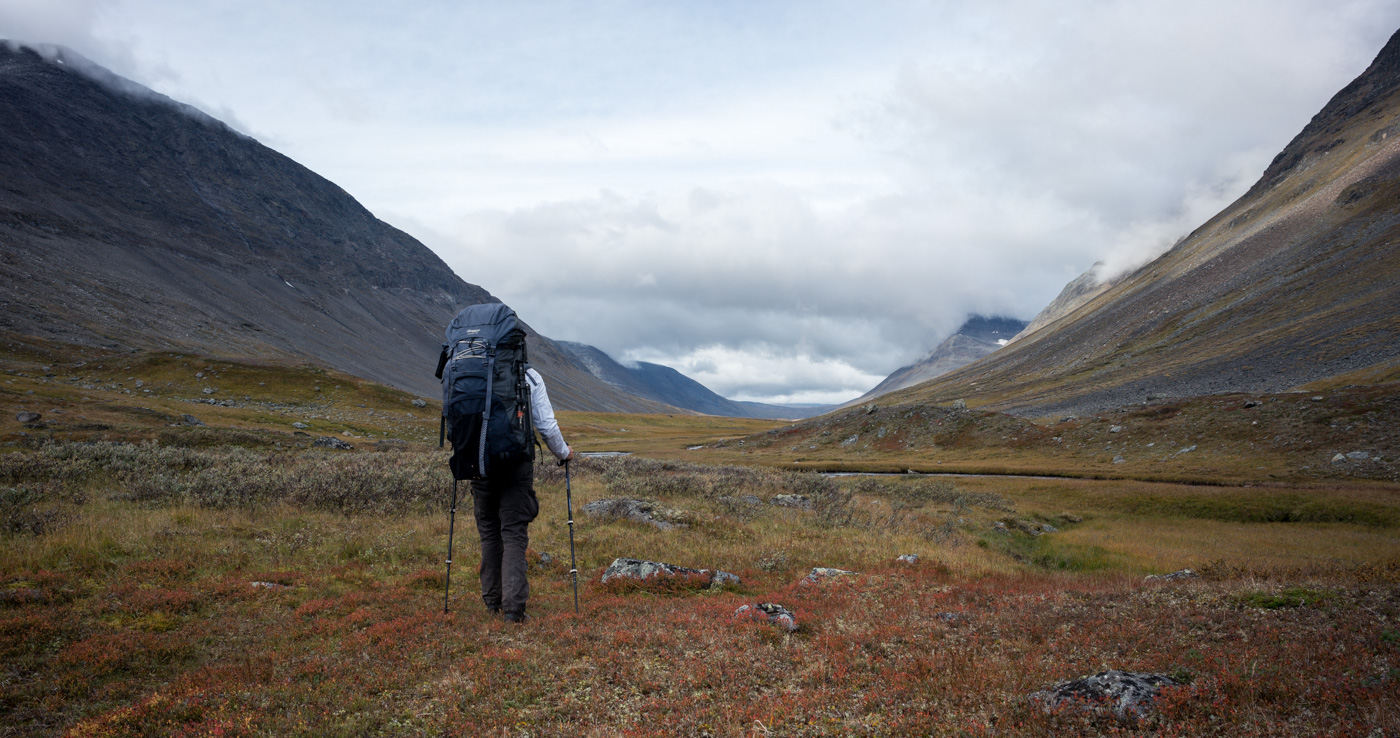
As soon as the V-shaped cut of Niejdariehpvágge comes into sight, and the slope to my left seems manageable, I try to gain altitude. After climbing a rather steep section, the view to the lake Álggajávrre finally opens up.
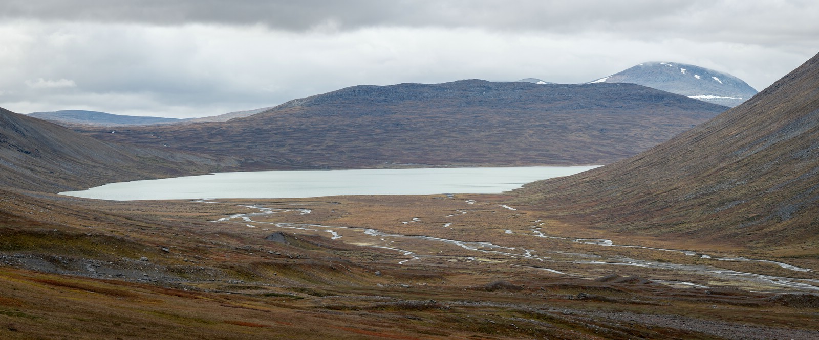
I walk steadily uphill to the south into Niejdariehpvágge. I still remember strenuous passages over boulders from my previous trip. Surprisingly, the terrain remains relatively easy at first. Probably it is due to the fact that this time I walk at a slightly higher altitude.
The ground gets stonier over time, until I reach a small pond at the pass. Here I am surrounded by rocks and scree only. On the horizon the high plane of Luohttoláhko and the peaks of the Pårte massif come into view.

A steep descent over rocks and boulders follows. I have to use my hands to get down. A short time later I encounter a snowfield which, interestingly enough, has formed a crevasse like a mini glacier.
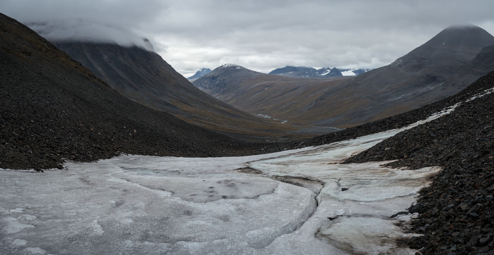
The snow is icy, so I prefer to descend further across scree at the edge of the snowfield. Five years ago it was possible to “slide” down on the snow.
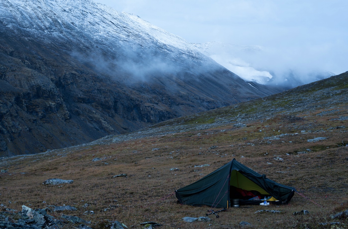
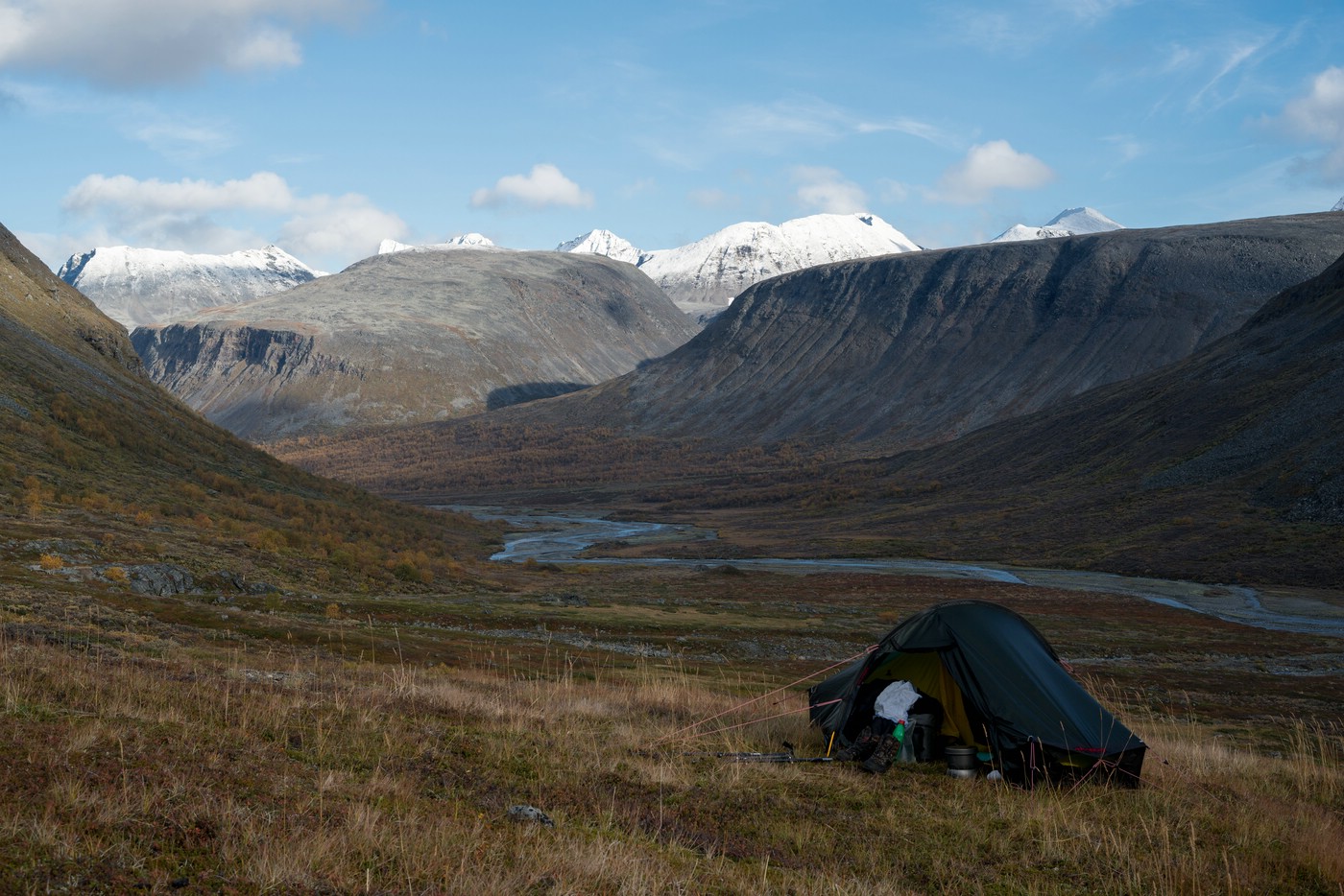
Meanwhile a drizzle has begun to fall. I decide to set up camp before reaching the valley floor. The view from my campsite is very rewarding. When the rainfall gets stronger it’s time to move into the tent.
Day 7: Sarvesvágge
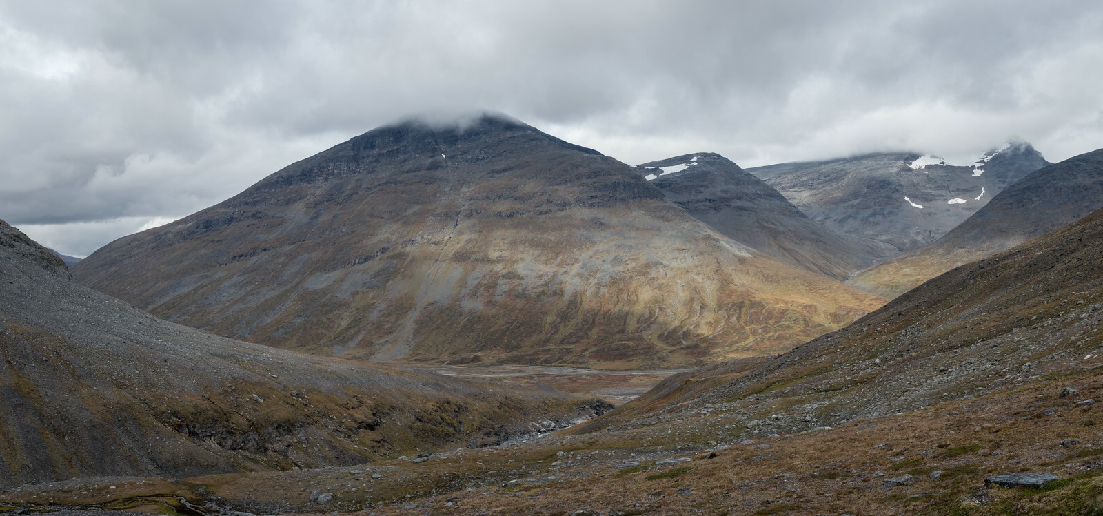
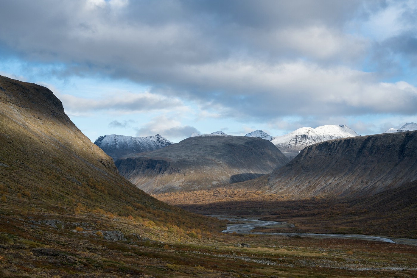
The rain stops in the morning. At sunrise I have a look outside and see a different landscape: all the mountain tops are covered in snow.
The snow line is really interesting to see. I had hoped for such conditions, but they hadn’t yet arrived. Of course, the whole thing is accompanied by a significant drop in temperature. I use the opportunity for first photos in the morning light.

After the photo session I prepare my breakfast. I’m happy about the hot food, it makes me warm up. This day is really starting out well!
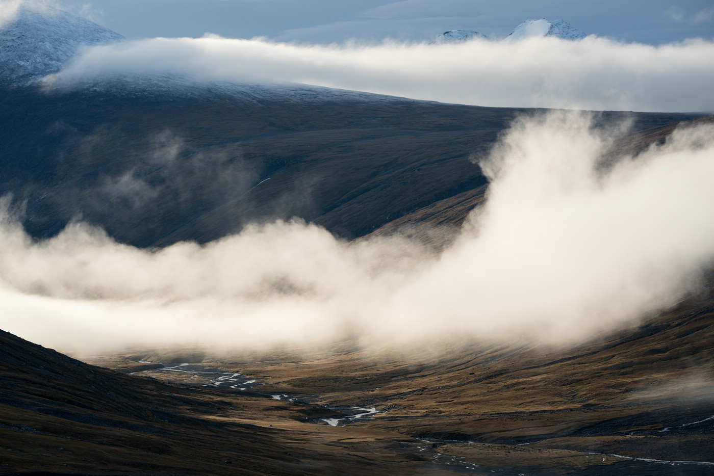
Over time, fog builds up in the valley below and also on the Luohttoláhko plateau.
I’m not sure how to go on. I essentially have two options in mind:
- After reaching the valley floor I climb up to Luohttoláhko (as originally planned).
- I follow Sarvesvágge towards Rapadalen.
After the clouds get thicker and the Pårte mountain range disappears completely, I choose option 2. On the plateau I probably wouldn’t see much which could make orientation difficult. If the weather continues to deteriorate, it would also be very unpleasant there (wind!), and I might have to wait in the tent for the weather to improve. In addition, snow could complicate the situation.
The decision is taken and I make my way down into the valley. When I reach the run-off of Rijddajiegna, it starts to drizzle. Instead of looking for a better crossing location, I take off my boots and ford the stream. Then I continue along the north bank of Sarvesjåhkå.
Every now and then it is drizzling, but fortunately no stronger rain sets in. I know what to expect further down the valley, as I’ve been here four years ago. In the beginning, it’s pleasant walking on grass and heather. Later, however, more and more brush will make the passage strenuous.
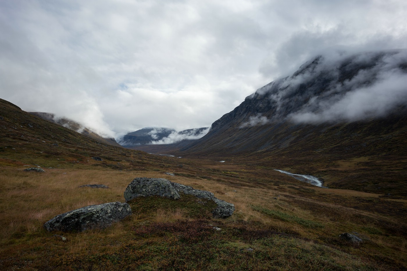
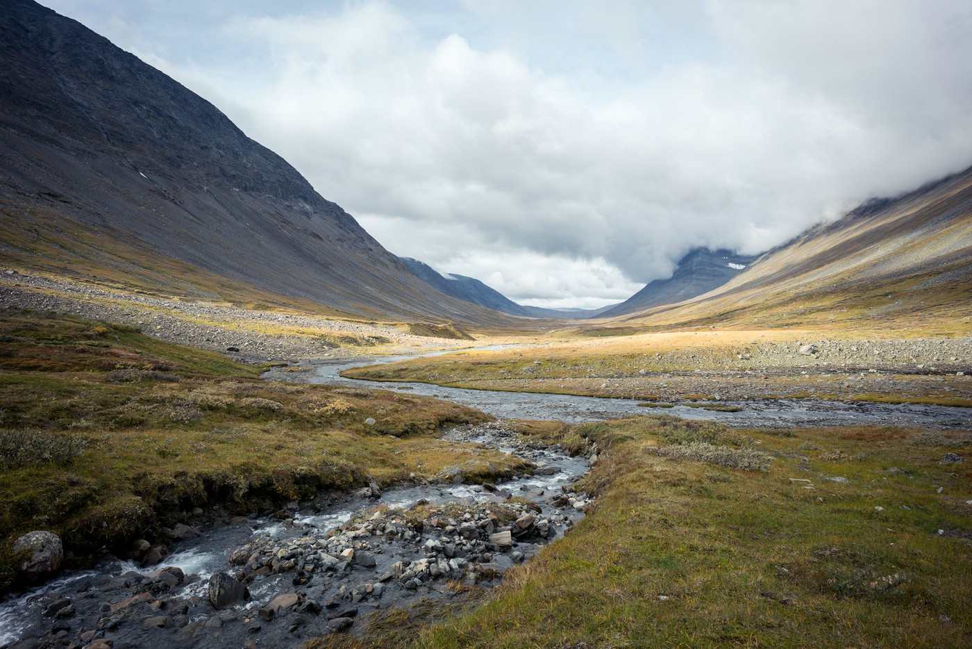
Since I want to keep the option of an ascent to Dielmájávrásj open, I don’t continue hiking along the river, but try to keep the altitude to avoid ascending again later-on. The terrain now looks like in the following image:
Again and again I climb up or down a little bit, if the vegetation is less dense there. Unfortunately, the weather deteriorates over time and a persistent rain sets in. It’s also quite windy. Around noon I see a small grassy flat with a view of the valley: this is my campsite. There’s sufficient time left, especially since the chosen route is slightly faster.
When my tent is ready, I lie down inside and relax for a few hours in my sleeping bag. Later-on it suddenly gets really warm, and I take a look out of my tent: The sky is now mostly blue.
A small photo session is what follows. I capture the fast moving clouds and light spots scurrying over the autumn landscape with a small time-lapse sequence (can be seen in my trip video). In the following a photo of the scenery:
If the weather remained that way, I could climb up to Dielmájávrásj tomorrow. I’m looking for possible ascents on the slope, because the my last chosen ascent route four years ago was a disaster.
In the evening clouds move in again and I don’t get any sunset. The mountain slopes disappear in the clouds. At night there’s a lot of rain.
Day 8: Sarvesvágge – Skårki Hut (Rapadalen)
The new day begins with bleak weather, the cloud are so low that the opposite slope is invisible. At least it’s not raining (yet). I take my time for breakfast and then get my things packed. Today (like yesterday) I put on my rain pants directly (with long underwear underneath) since it doesn’t look like it will remain dry all day. I decide to follow the valley floor towards Rapadalen. The route up to Dielmájávrásj makes absolutely no sense in these conditions.
From my campsite it is not far to the glacial run-off Rijddanjunjesgågåsj, which I have to cross. I reach the stream at a place where it has washed out a canyon. At this point, my guidebook says, it would be possible to jump over the stream. Since all the rock is wet, and the distance is considerable (at least with a heavy backpack), this would be life-threatening.
So I hike further downhill until I reach a place where it is possible to cross. The water level is low as with all previous streams. Considering the amount of rain in the last two days/nights this can’t be taken for granted. In fact, I was a little worried that the crossing of the Ráhpaädno river – the largest stream in Sarek – later-on might be challenging. At the moment I think it should pose no problem (if the weather doesn’t deteriorate significantly).
On the other bank of the stream I descend to the banks of Sarvesjåhkå. It starts to drizzle.
It’s a miracle that I manage to close my camera bag again to make it waterproof. It requires a lot of patience. Now I don’t have to put the camera in my backpack.
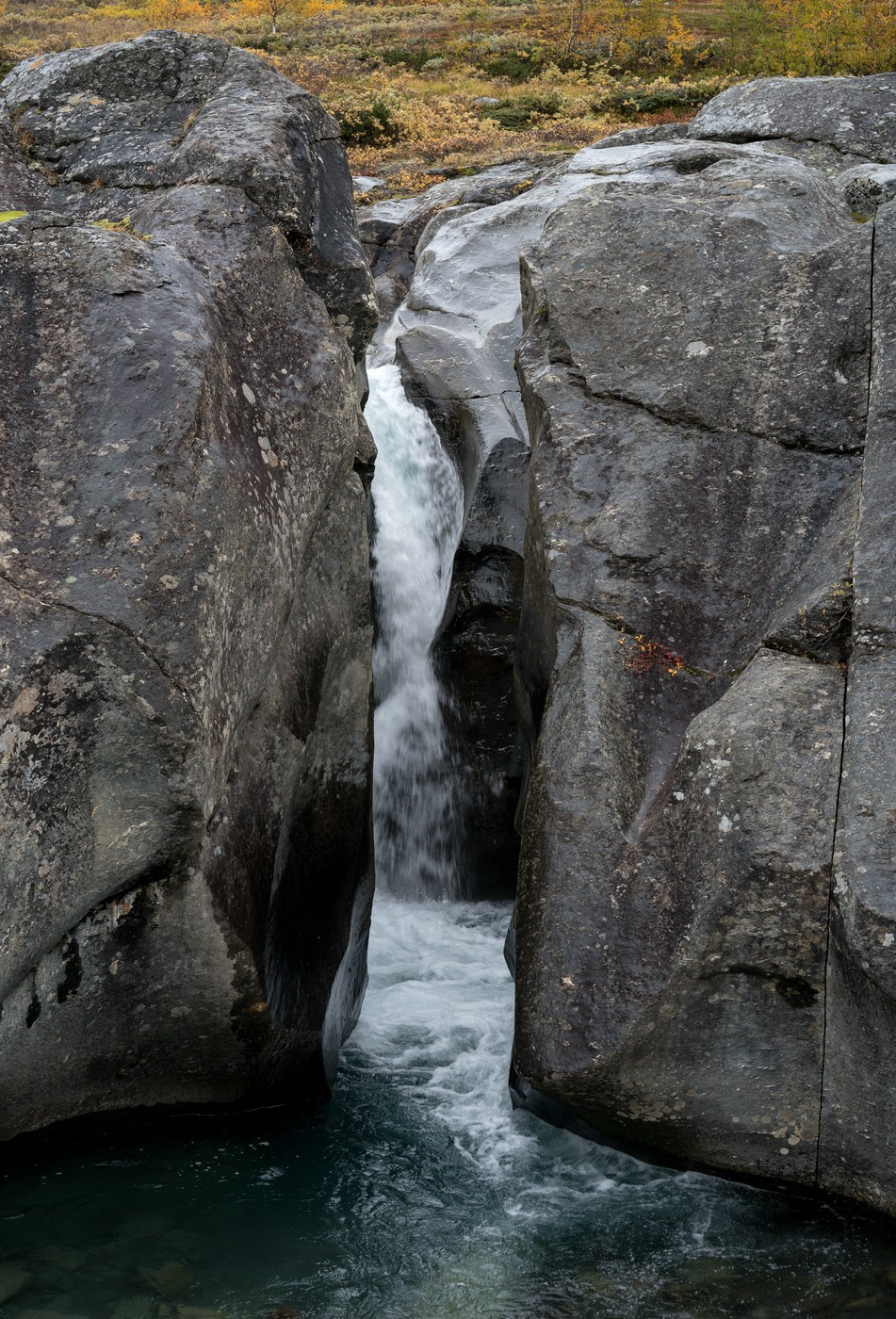
Down by the river (as you can see above, the Sarvesjåhkå also carries little water) I can walk a few hundred meters on sandbanks before the main arm cuts off my way and bush-whacking is required. Now it’s really raining and all the vegetation is wet. The temperature is about 3-4°C. As you can imagine, my mood is not necessarily at its peak ;-).
Every now and then a few sandbanks appear, but most of the time I have to cross rough and swampy terrain. Game trails or footpaths that I come across I usually lose again soon. It is tough progress. The rain never stops, and in fact it will go on until the morning of the following day.
Nevertheless there are beautiful things to see: The birches in their autumn dress glow in this weather. But I don’t take any more photos today. Who knows if I will get my camera bag locked again. Will I be able to dry my equipment in the next days?
After some time I see three moose at a distance of about 200 m. They stare at me and I stop walking. I don’t want to disturb them or even encourage them to react aggressively. So I stand still for maybe 3-4 minutes until they move on. I meet them two more times and every time they watch me. Every time I wait and behave calmly.
When I’m approaching Rapadalen, I aim further north, away from the river, and walk through birch forest, which is interspersed with moorland. There is only one place where the main river in this valley – Ráhpaädno – can be forded. This location is my destination. It is recognizable by an island with a steep edge between two arms of the river. Unfortunately, I have no visibility at first, so I roughly walk in the direction I expect to be correct. The ground rises and falls. From an elevation I finally get a view into the valley and see that I am on the right track and exactly walk towards the island.
Ráhpaädno fans out into many arms in this location (estimated 7-10). The two main channels are on both sides of the island. I’m quite exhausted and totally wet. Besides, I have cold hands in spite of my gloves (which are soaked, too). When I reach the open terrain, there is a strong wind. Imagine how much fun I have to take off my shoes now and then cross the river. It’s about 1 km from the first to the last arm of the river. Four years ago it was a sunny and warm day when I did this crossing. Back then it was almost a welcome refreshment.
Well, it was a refreshment this time, too ;-). At least I’m lucky with the water level. Since my feet don’t dry in this weather, and my shoes and socks are already damp, I put on my shoes as soon as possible and walk on. I am glad to have this key section behind me.
The route to Skårki hut – which is not open to hikers and a historical site – is dominated by scrub and swamp. But this is nothing new for me ;-). After a few kilometers I find a beaten path directly at the river bank. Unfortunately, it ends unexpectedly with a deep ditch :-(. So I have to backtrack and squeeze through tall willow bushes. In the brush my rain pants slip and a considerable amount of water finds its way inside. Awesome! My long underwear is soaked as well now…
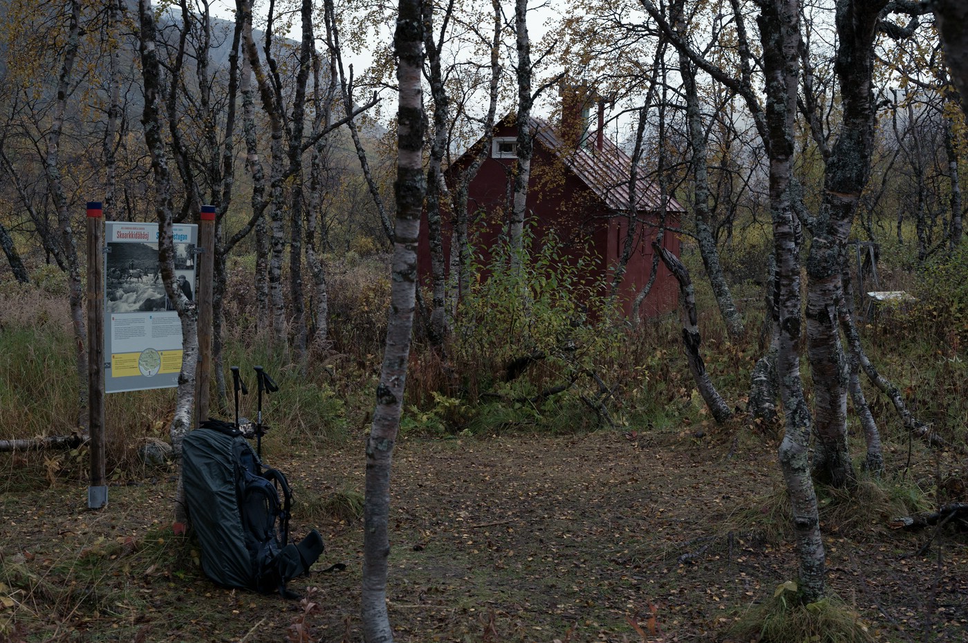
Suddenly the Skårki hut appears in the forest in front of me. What a surprise! I set up my tent near the hut. There’s a brand-new information board explaining the significance of this place (it didn’t yet exist two years ago). The hut was built by Axel Hamberg for his expeditions and research activities in the beginning of the 20th century. I strip down to my underwear and prepare some hot tea to warm up. I’m still shaking and my clothes are literally steaming from the body heat. At least the tea warms from the inside.
At some point I crawl into my sleeping bag and cook my dinner. I don’t go outside anymore tonight. The only sounds are the falling rain and the wind. At this point I regret not having taken a synthetic sleeping bag with me. My down sleeping bag has already lost a lot of loft and thus warmth over the last few days.
Interestingly, I haven’t seen any people since Álggavágge (day 5).