Day 4: Guhkesvágge – Bierikjávvre
In the evening I have been thinking about the next stage of my hike. Since the stretch from Saltoluokta to upper Rapadalen was unknown to me, and I was hoping for interesting photos at the lake Bierikjávvre, I have opted for a short hike today to enjoy the morning and evening light at the lake.
At night and in the morning there is some rain falling from time to time. This is not a real problem, but it delays my departure a bit. Fortunately, I’m not in a hurry anyway. I have a relaxed breakfast and get ready when a few beams of sunlight hit my tent.
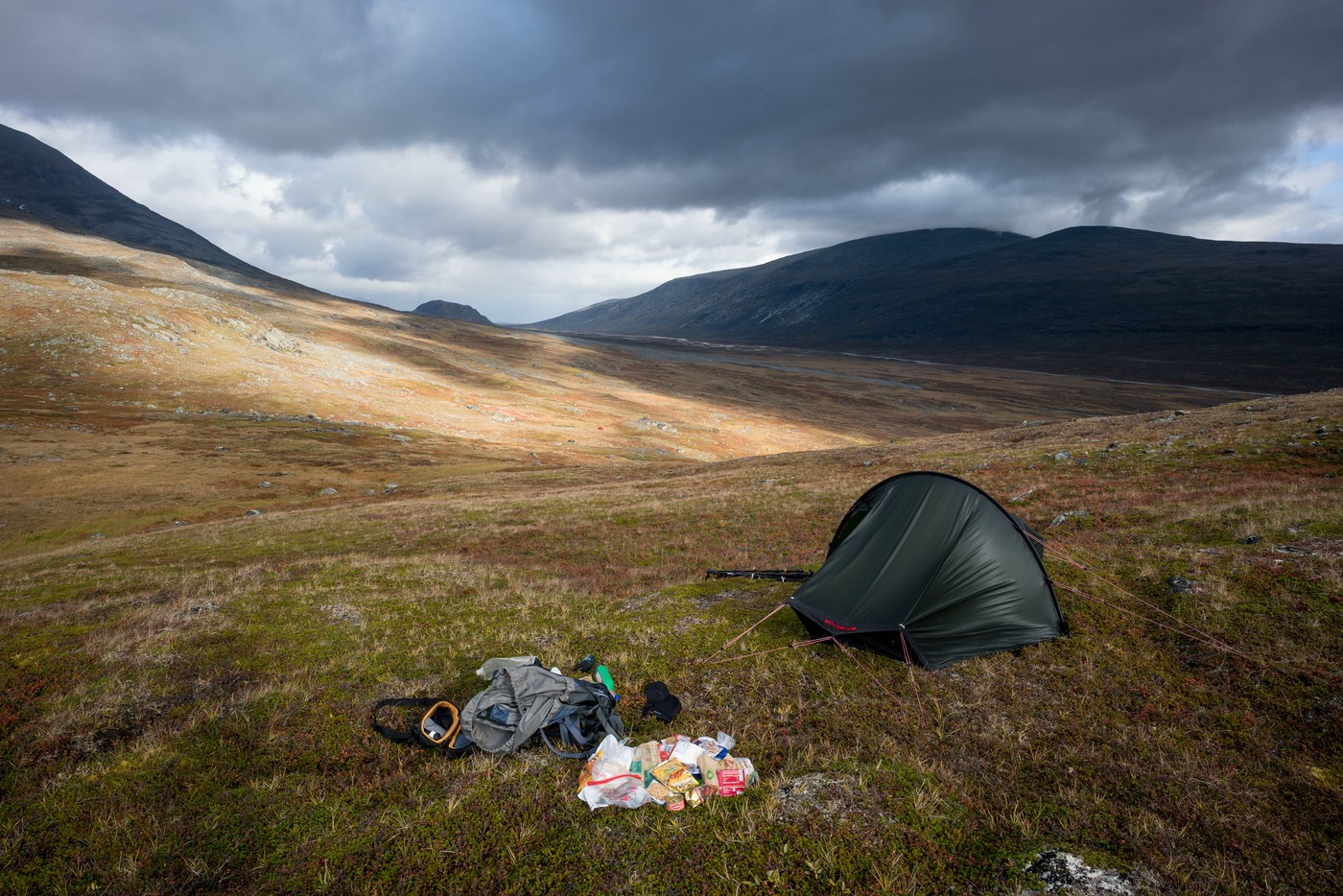
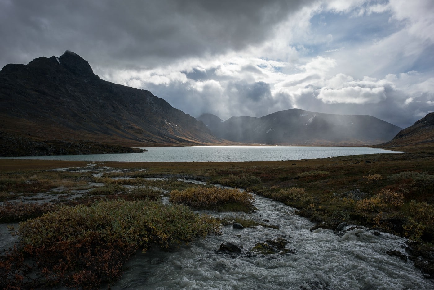
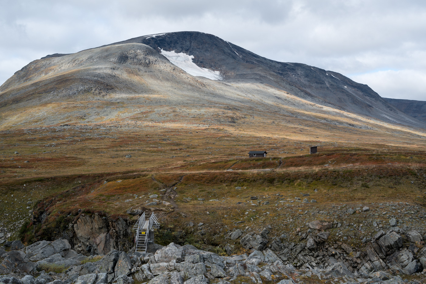
As mentioned before, my campsite is close to the top of the pass. When I get there, I encounter a dramatic combination of sunlight and heavy clouds. Hardly on the move, I stop again for an extensive photographic break. The view towards the stream Bierikjåhkå together with the mountains in the background is breathtaking. I have seen it yesterday, but with today’s light it looks even better.
Finally, at some point I decide that it’s time to go on and descend into the valley. The next stretch is easy to walk.
Down in the valley I meet a footpath that is easy to follow. I briefly consider whether I should climb the rise of Bierikvárásj. I even think about setting up camp on the top. However, laziness prevails. I don’t feel like crossing the river, and up there it would be too windy today anyway, wouldn’t it ;-)?
Several times I encounter small streams, which I can cross comfortably with my boots.
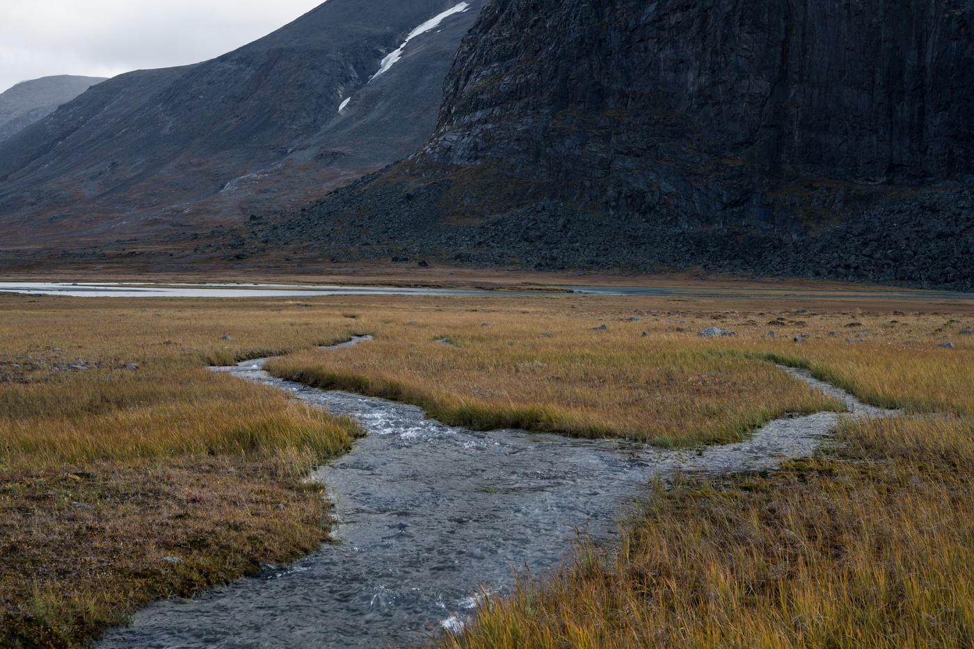
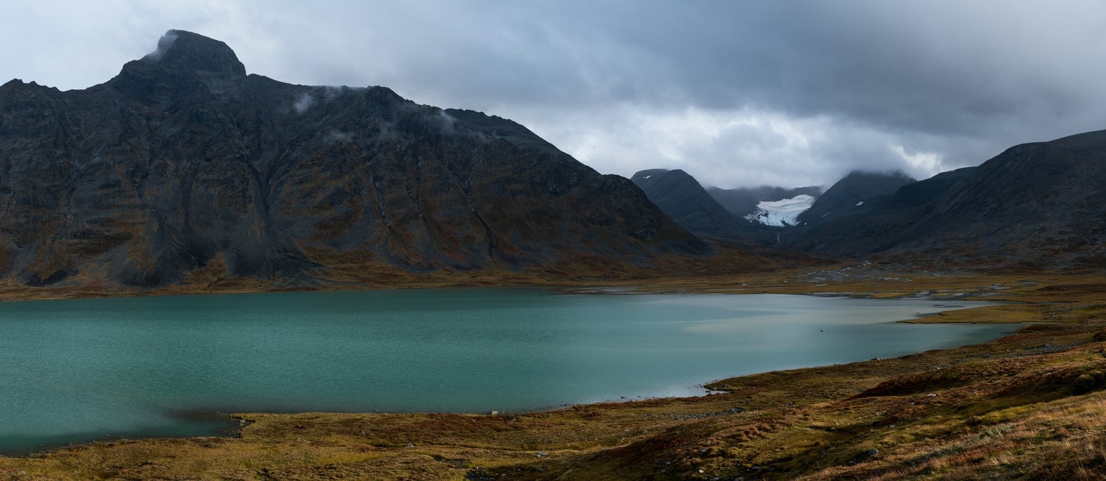
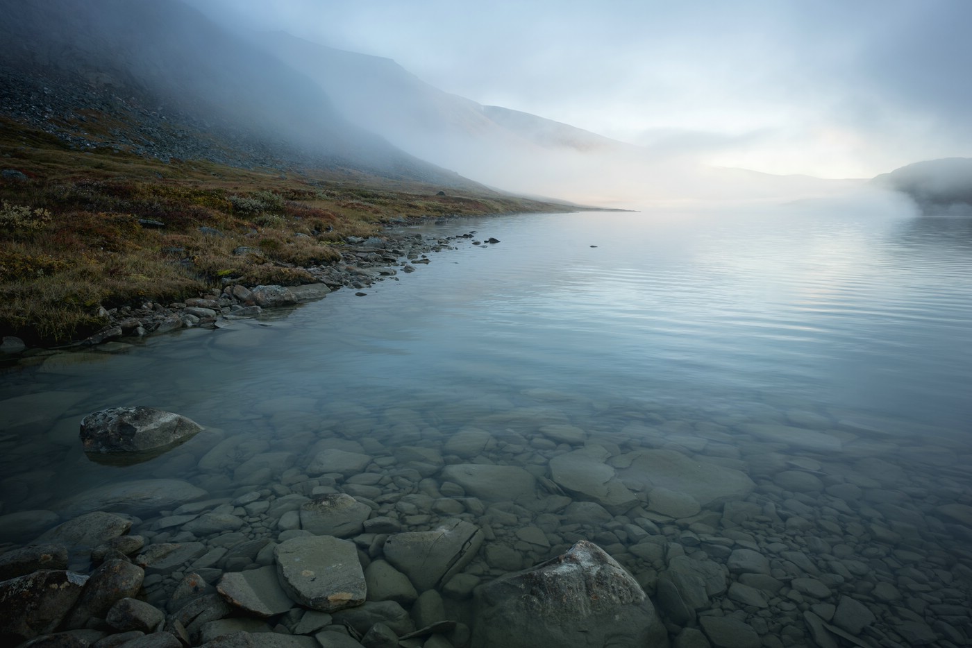
Slowly Bierikjávvre comes into view.
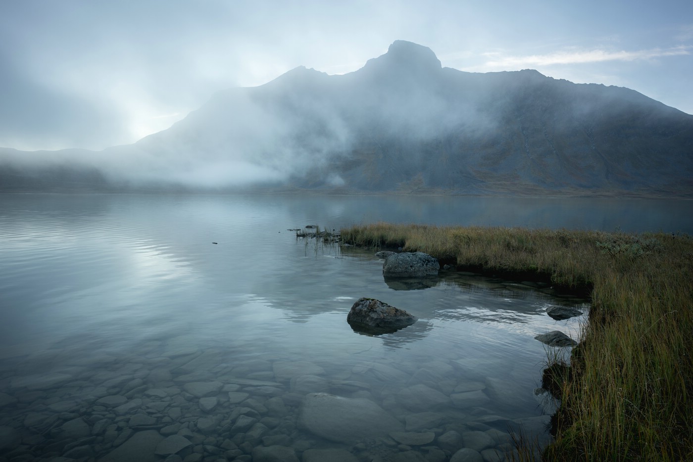
I walk along the west bank of Bierikjávvre and settle down as I find a good campsite. It is still relatively early and I take a few photos. Then it’s time for washing, eating and lazing around. Later, in the evening, I climb up the slope a short way.
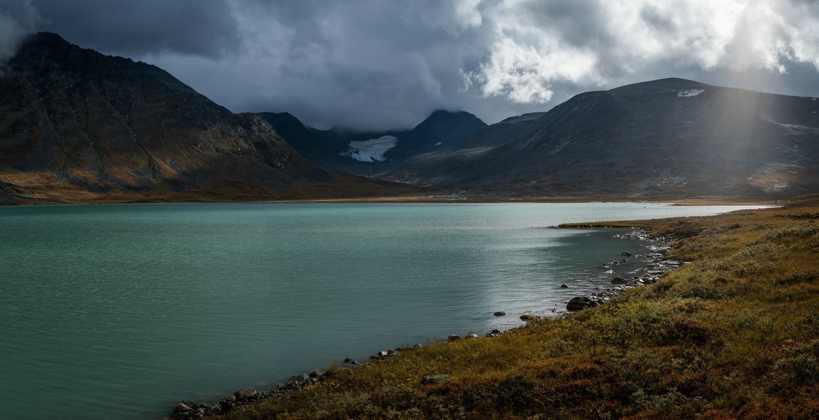
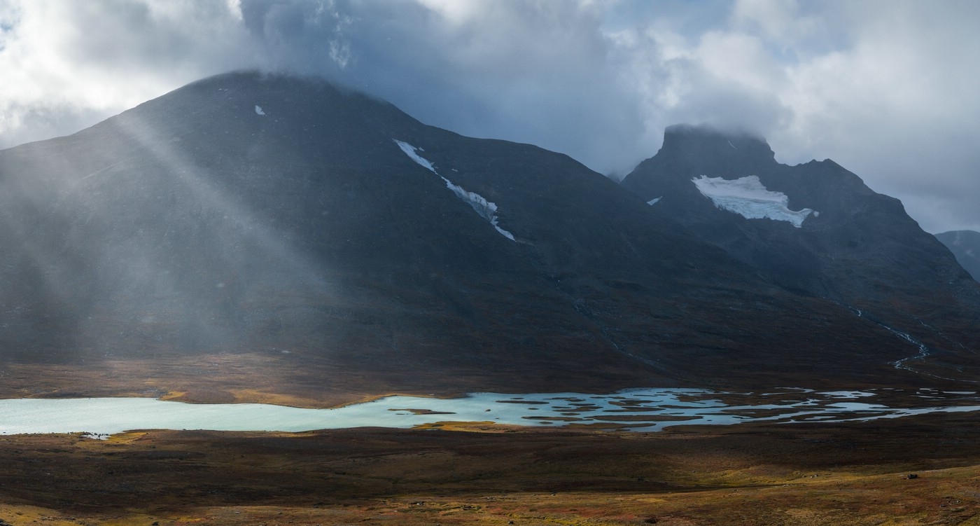
Although there is no spectacular light today, I really enjoy the views of the lake and the peaks beyond from the elevated position. The jagged shape of Bierikbákte dominates the panorama.
It’s been another great day and I’m looking forward to the next morning.
Day 5: Bierikjávvre – Álggavágge
At night the sky has mostly cleared up. This has resulted in a significant cooldown and a lot of condensation in the outer tent.
I wake up before sunrise and have breakfast. Then I get dressed and walk the slope again to take some photos. I won’t be able to see the sunrise today because the mountains in the east are way too high. Mist has formed on the water surface, which looks really interesting. I conclude that a “normal” sunrise would have been almost boring in comparison.
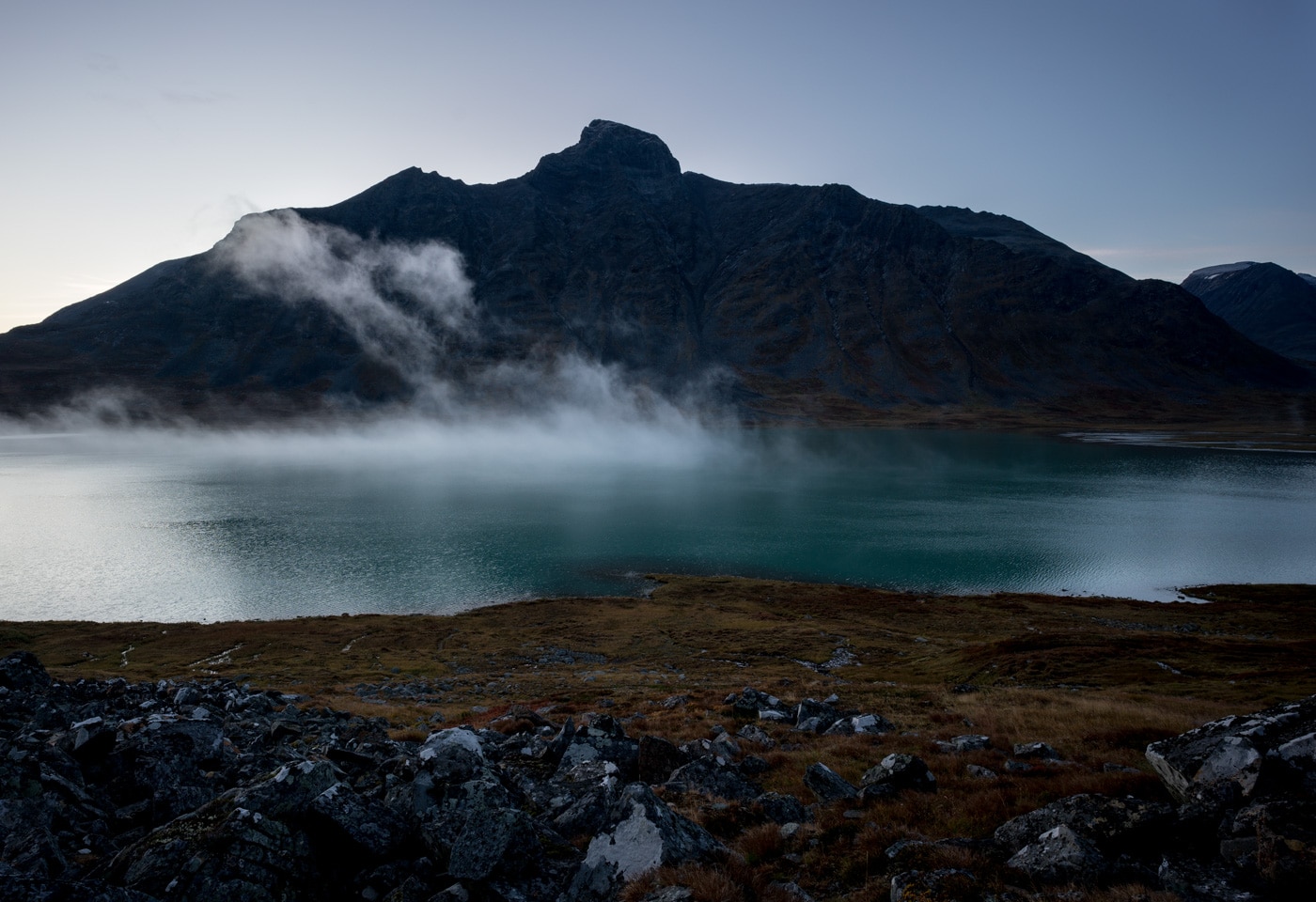
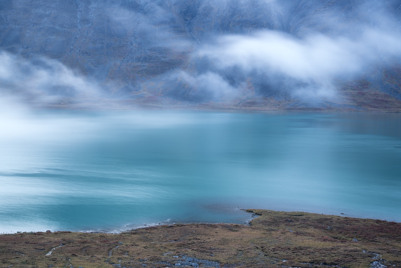
After I’ve had enough, I head back down to the tent. On the lakeshore I take some more photos. The mist is constantly changing.
Because of the steep rock face of Bierikbákte it would take a long time for the sun to reach my camp. Thus, I pack my tent in wet condition. Maybe tonight I will have a chance to get it dry. If not, I’ll just wipe it out.
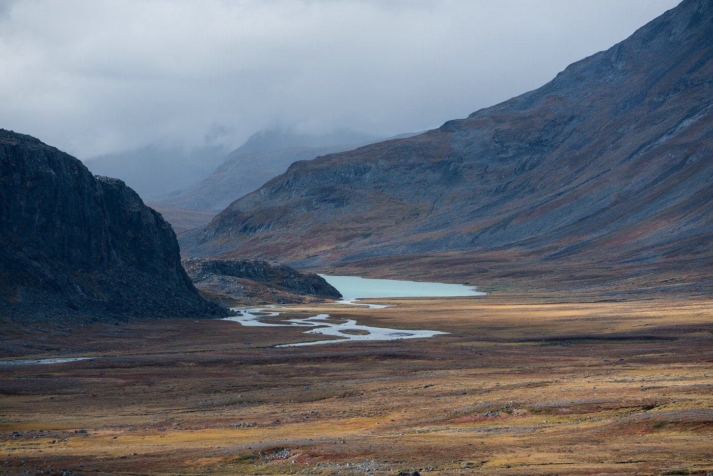
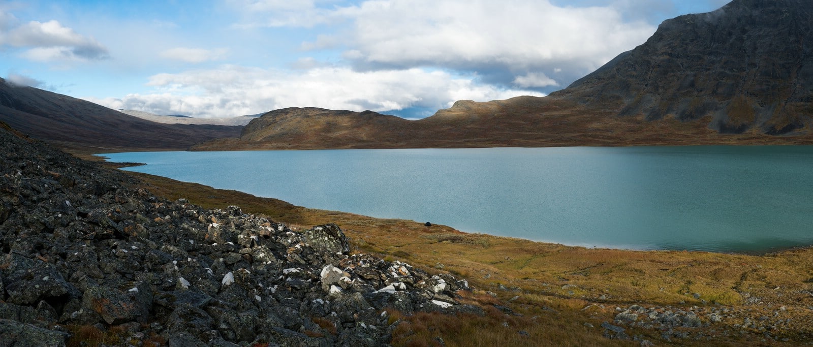
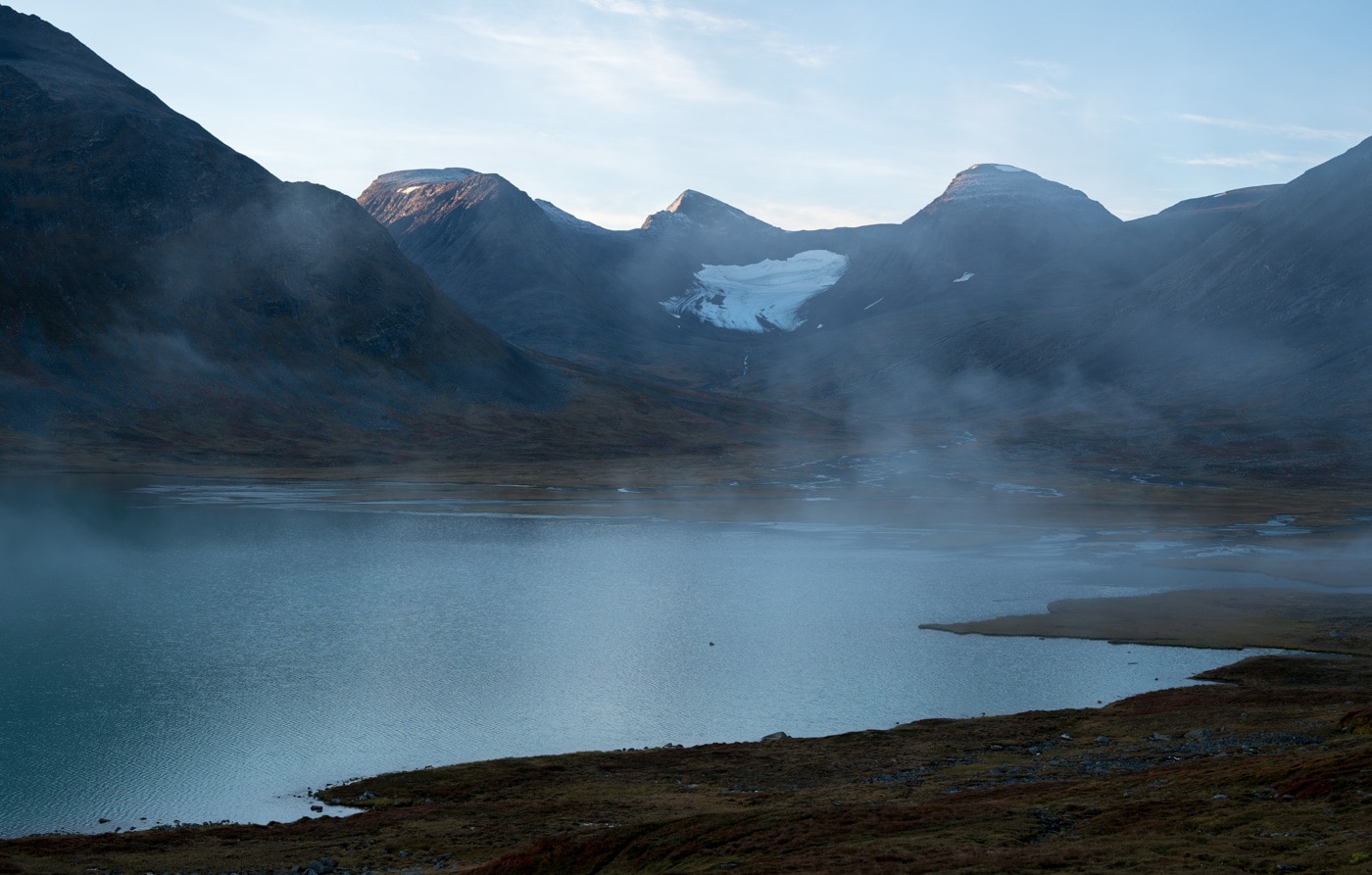
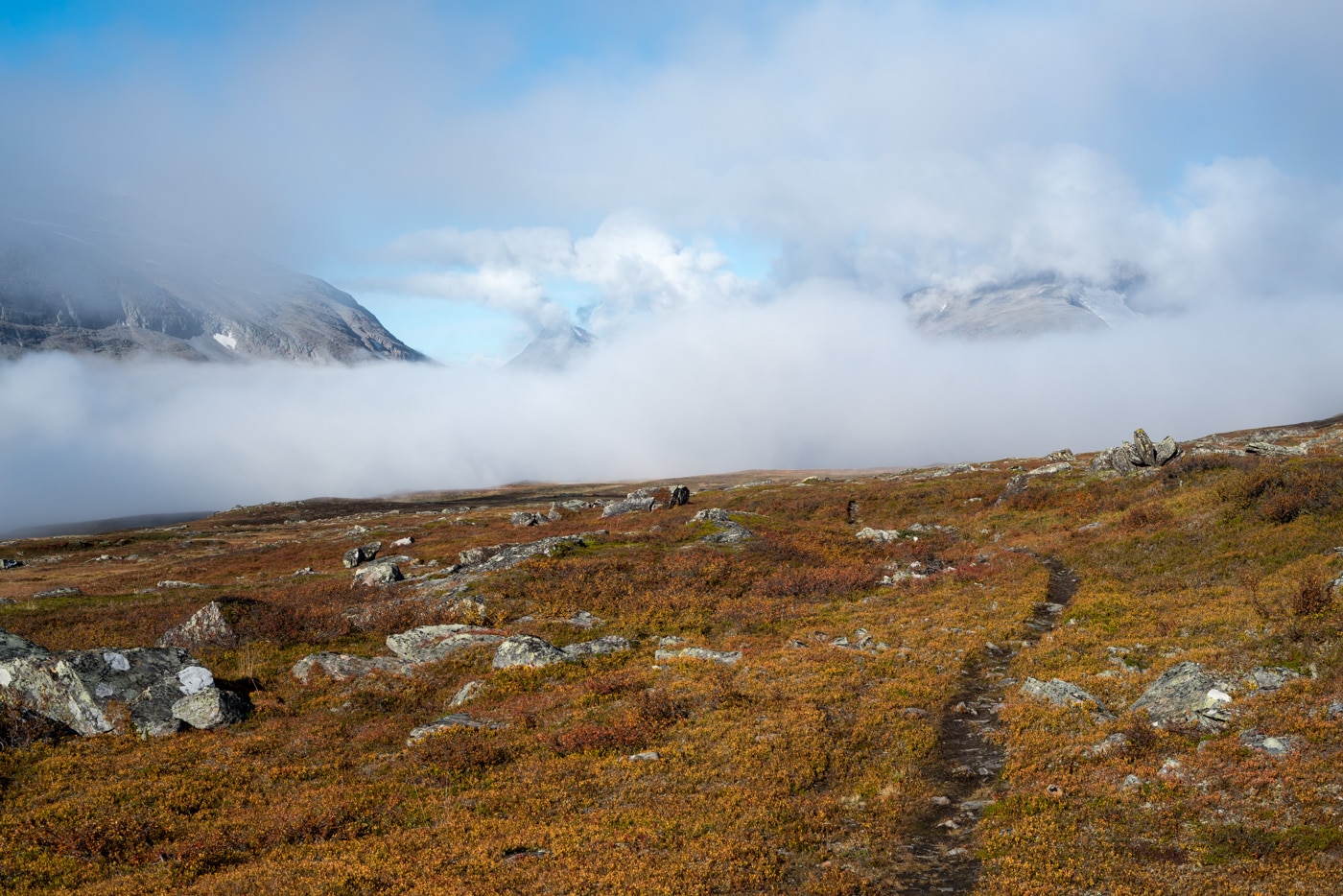
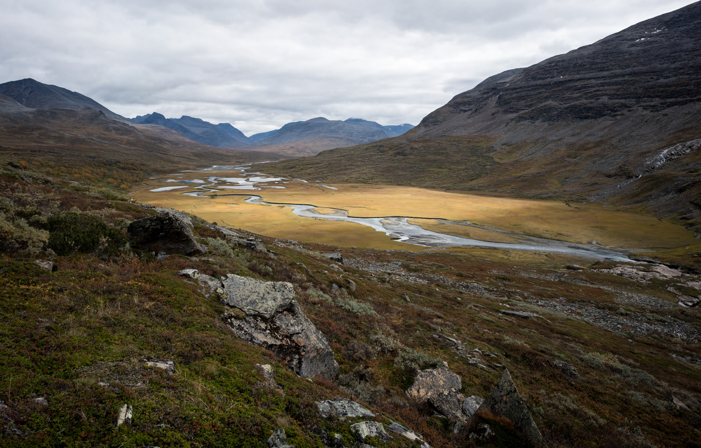
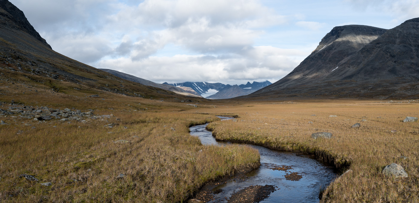
When everything is packed, I walk on towards Rapadalen. North of the lake Bielajávrátja I stop for some more photos. Also here, the mist creates interesting moods.
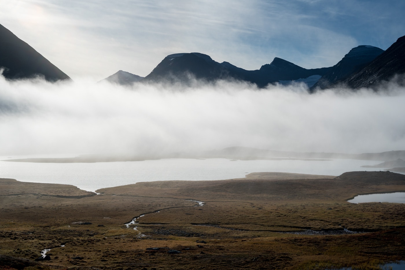
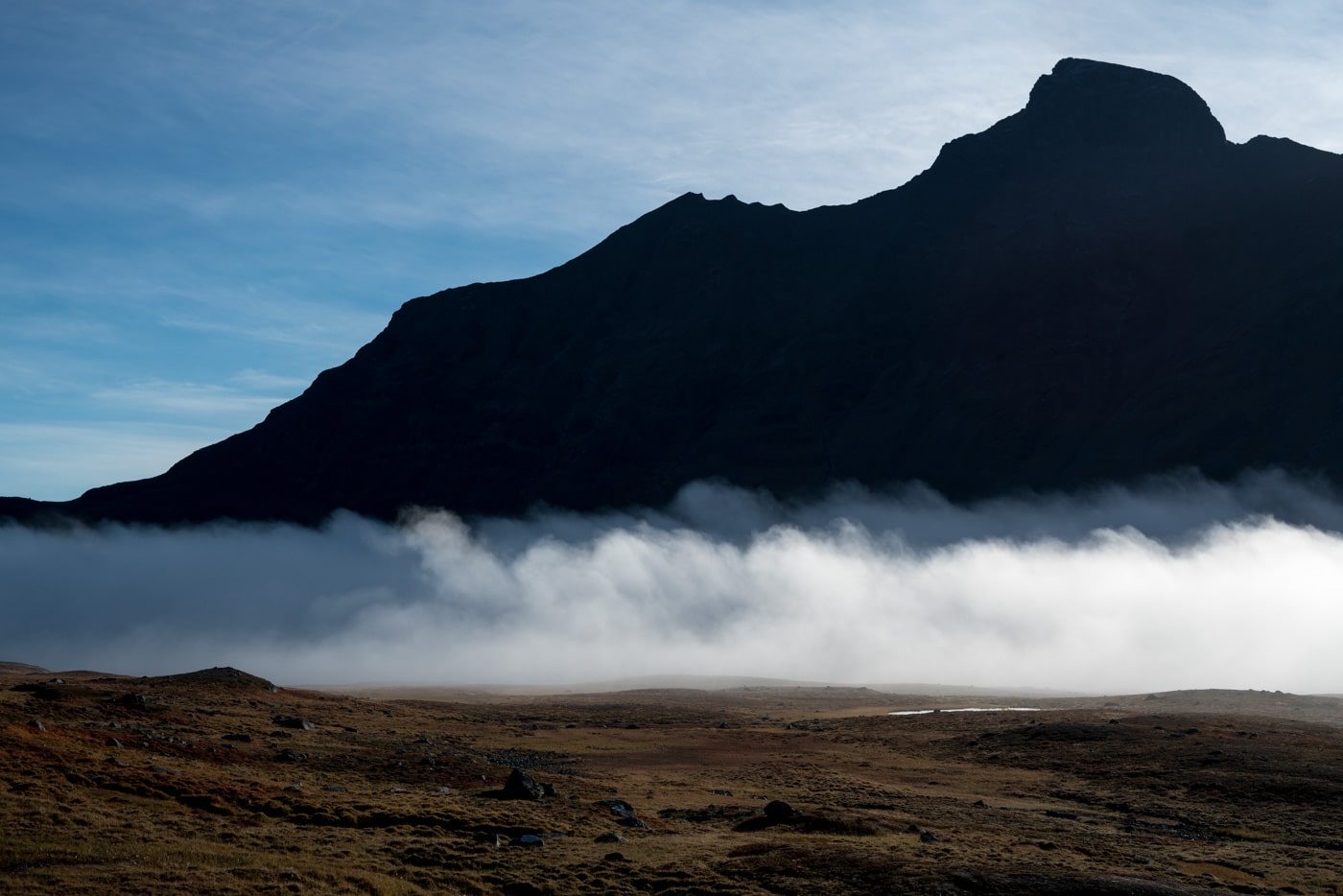
When I reach the upper section of Rapadalen, parts of the valley are shrouded in mist. The sun, however, is trying hard to drive it away.
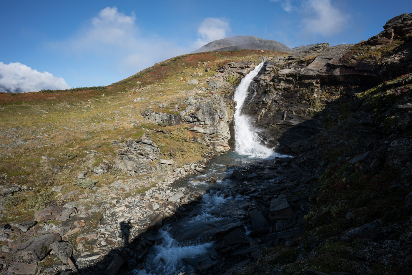
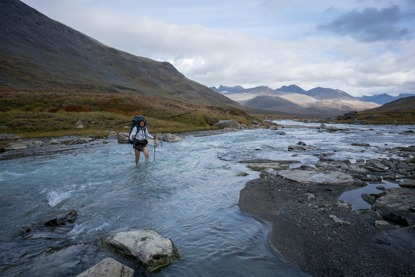
At the stream Tjåggnårisjåhkå I meet a path that I have followed two years ago. It leads to Snávvávágge. Crossing Tjåggnårisjåhkå requires taking off my shoes, although the water level is not very high. That doesn’t bother me much in the sunny weather. Before crossing the stream, I take a photo of the waterfall nearby.
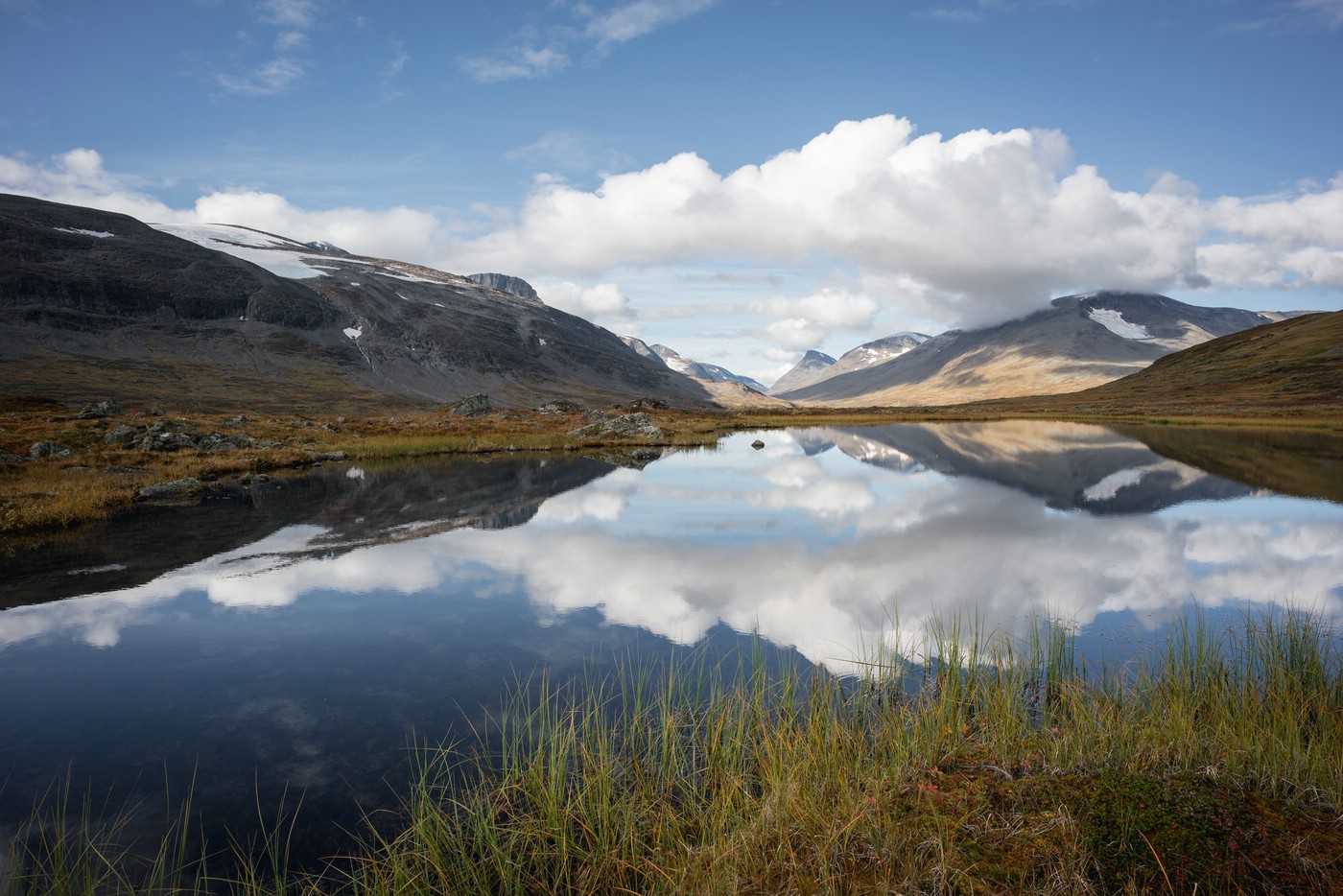
The further way to Skárjá (where an emergency shelter is located) leads across marshes and past one or the other small lake. Far to the west, the peak of Guohper is particularly striking.
This is where the trouble with my waterproof Ortlieb camera bag begins. The zipper gets caught somehow and only with a lot of fiddling I get it closed again. I’m quite annoyed by that. Later I will close the bag only halfway in dry weather, to prevent the camera from falling out.
Before I reach the footbridge across the stream Smájlajjåhkå, I meet two hikers who are on their way in the opposite direction. They started their hike in Sulitjelma in Norway and came here via Álggavágge – where I am headed today.
I’m taking my lunch break next to the bridge, which is in place only in the summer. In fact, the bridge across Smájlajjåhkå will be dismantled in about a week. I had requested this information from the responsible authorities beforehand. A missing bridge would have required a longer detour as the stream is impassable.
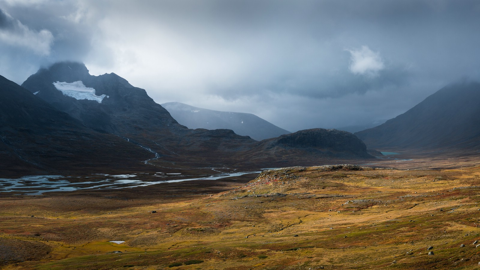
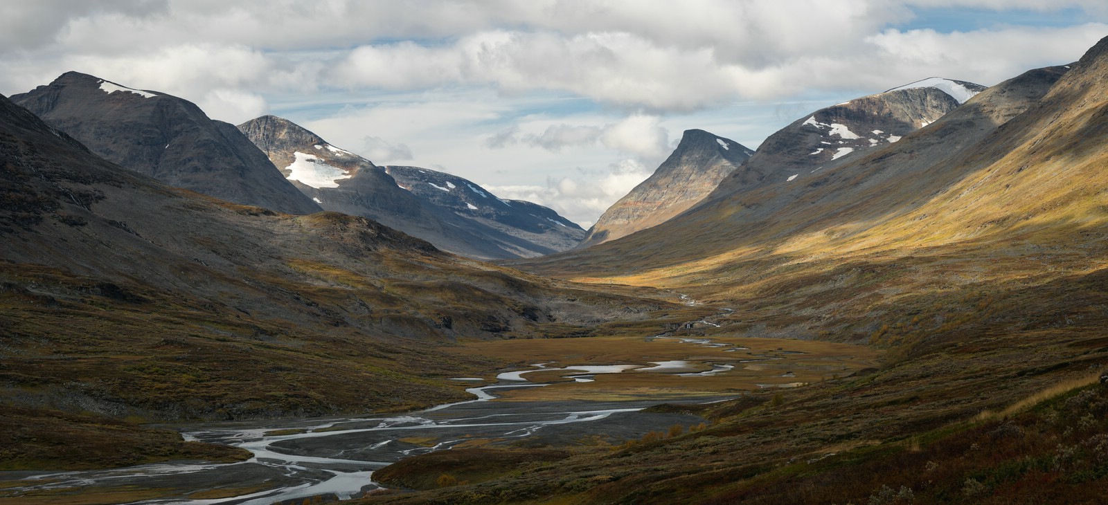
After my rest I go on in westerly direction. This section up to the eastern end of Guohpervágge features some game trails but no real footpaths. Whenever you think you have finally found a path, it disappears soon again. Thus, I trudge through rather unpleasant terrain. But the views of the river and also towards Guohpervágge compensate for it. (If only it weren’t for that stupid camera bag…)
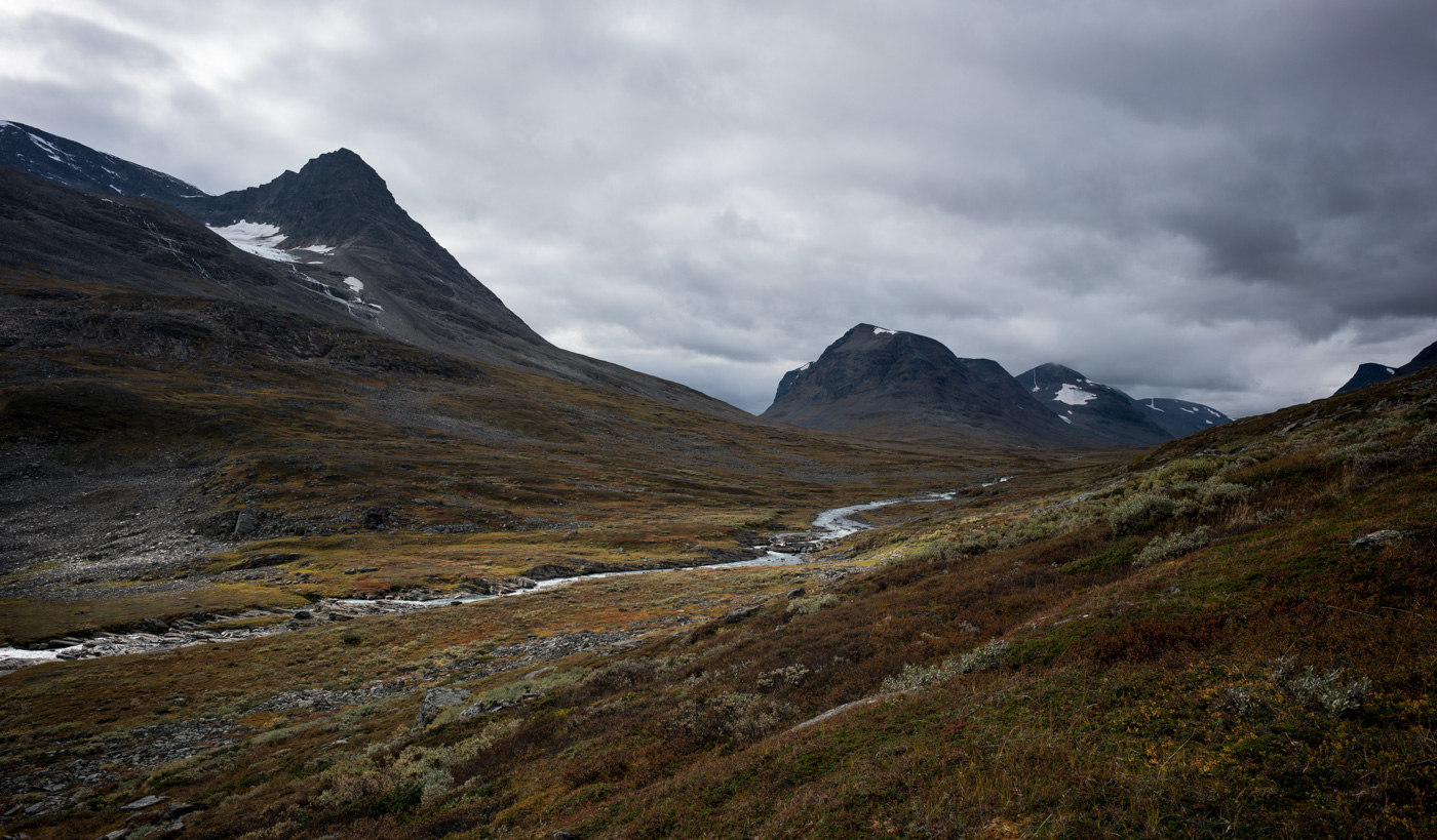
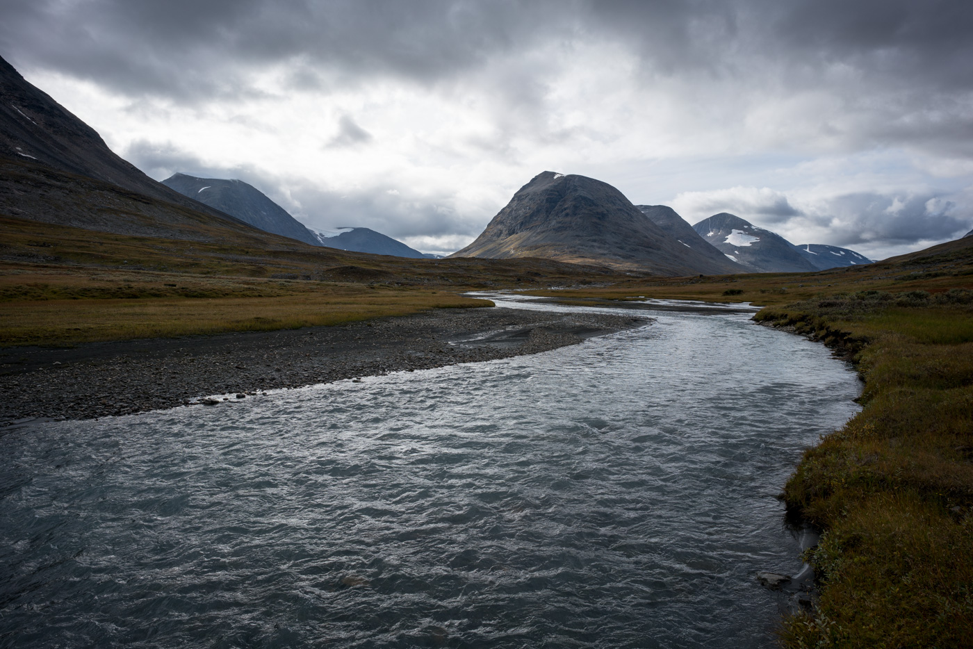
As you can see in the images above, clouds have moved in. Fortunately, it remains dry so far. In Guohpervágge there is finally a trail again, which I follow until reaching the confluence of the streams Áhkájåhkå and Guohperjåhkå. A few meters upstream from that location I cross Guohperjåhkå.
On the other side of the stream I ascend the slope and meet a reindeer herder’s hut. There is also a reindeer fence here, which spans the entire mouth of Álggavágge. In the fence there is a passage for hikers. It is worth mentioning that the reindeer roaming the mountains are property of the Sami, indigeneous people who have been reindeer herders for centuries.
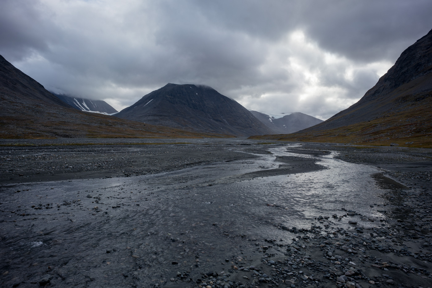
At the entrance to the valley, the Áhkájåhkå is widely branched and flows across gravel flats. It is hard to imagine the water masses to be found here at times of snow melt.
After having left the gravel, I follow a pleasant trail across grassland. This section of Álggavágge is sometimes referred to as “world’s largest soccer field”.
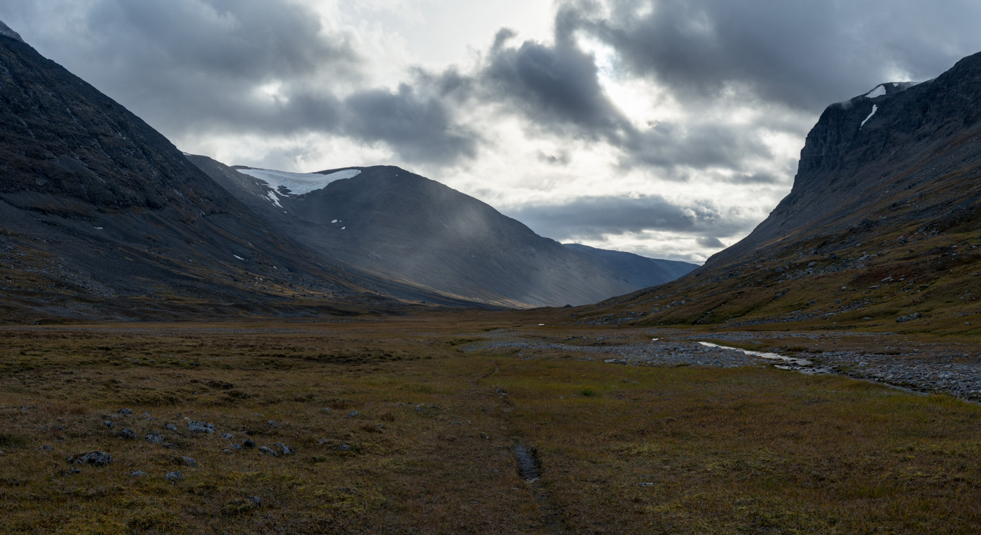
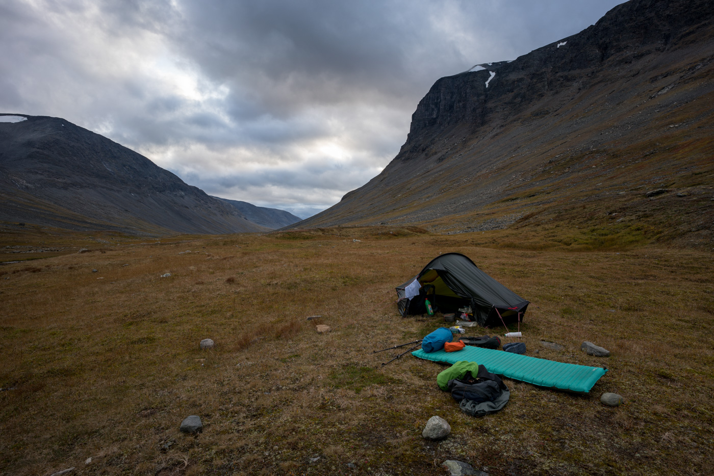
Álggavágge forms a slight “bend” in its middle section. Just before reaching this bend I set up my camp. While it’s grassy here, further west there’s a lot of brush and swampy terrain. When fussing with my tent, two hikers walk past. At this point I don’t know that the next human beings I’ll encounter in 6 days from now.
My tent is still wet. Thus, I dry the tent floor with a cloth (that also acts as a towel). Drying would take too long by itself in the current weather.
I wash myself and some of my clothes at the creek (of course without soap to not affect nature). Then I prepare dinner. I don’t take many photos tonight as the light doesn’t play along. At least, I see a lot more of the mountains than I did on my first Sarek trip 5 years ago. At that time, the clouds were just above my head.