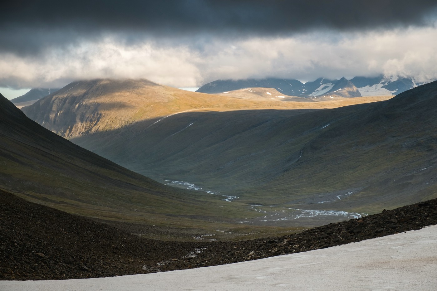
Until a few days ago I have been hiking in the mountains in the very north of Sweden. My exploration lasted almost two weeks. The longest part of my hike was within the boundaries of the national park Sarek, the most mountainous area in Sweden. This largely untouched area is only accessible on foot and has no marked trails, accommodations or other man-made infrastructure (except for a single emergency phone and two bridges).
This means you have to carry a large amount of supplies in addition to tent and other gear. Of course, I also took a camera and tripod with me leading to an initial backpack weight of almost 30 kg.
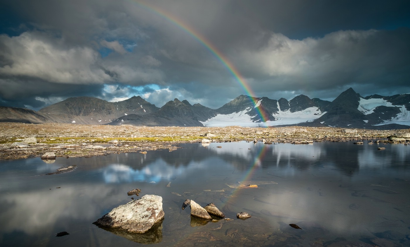
I have just begun to review my pictures, the above are two samples. Unfortunately, I lost some shots due to a defect of a memory card. Nevertheless I am happy with the results and will setup a new gallery in the near future, so be sure to check back.
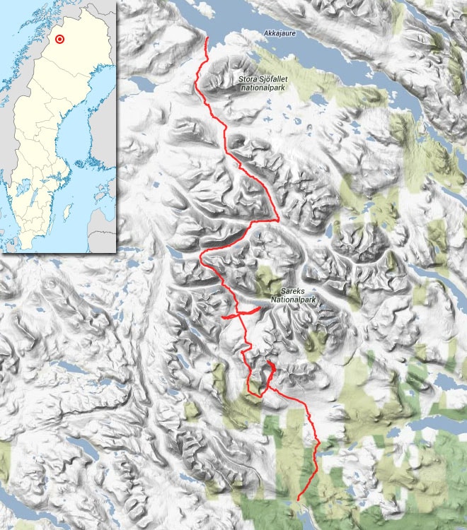
For those interested in my actual hiking route I created the following plot:
Hi Stefan Rieger,
Great post! I’m really interested to go to sweden. Initially i wanted to go to tajikistan this year, but because of corona Sweden sounds like a good alternative 😉 Do you maybe have the gpx file of this track? And also of the other one where you describe you have walked mainly in the southern part including rapa valley?
Best, Jaap Wijnen
Hi Jaap,
thanks for your feedback! I’m sorry to tell you that I do not provide GPX files. More about my reasons can be found here.
However, if you have any questions about the area, I’m happy to answer your questions.
Cheers
Stefan
Dear Stefan. I found your map route from kvikkjokk to ritsem (ON FOOT THROUGH THE MOUNTAINS IN SWEDISH LAPLAND (MORE PICTURES TO COME)
AUGUST 22, 2013 STEFAN RIEGER ) but there is no more explanations.
I am curious how was it. how long took you. how difficult is your route. looks that the south you climb to a glaciar , is this dangerous for medium level experience? you did this route by yourself or you was following a map trail?
sorry for so much questions.
but this route looks nice.
thank you.
kind regards.
Hi Victoria,
if I remember correctly the trip back in 2013 was 10-14 days. It was my first hike in this area and I was not very experienced myself. What you see in the image is not a glacier, but a snowfield. There were two detours to reach summits.
I planned the route myself, but changed the southern section during the trip as I got a few tips from another hiker I met :-).
Cheers,
Stefan