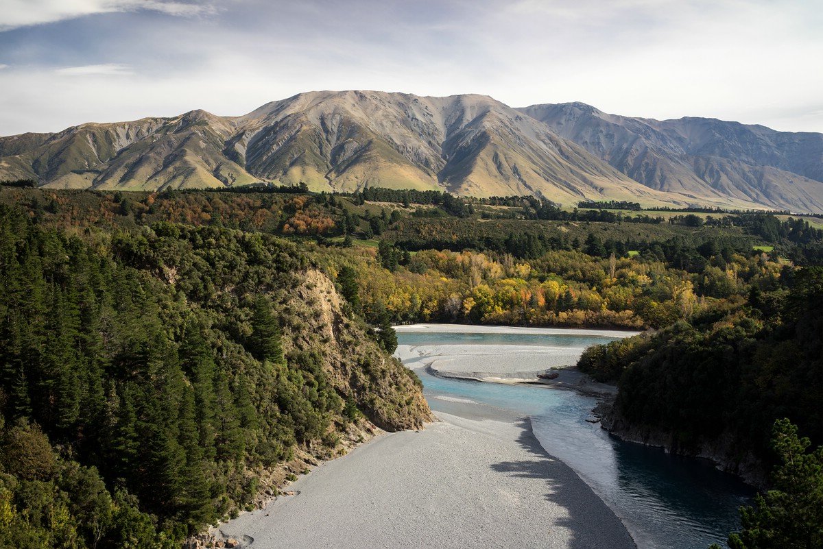
This is the last part of my report on my trip to New Zealand’s South Island. From Karamea I headed back to Westport and from there to Nelson and up along the coast to the small village Marahau at the southern end of Abel Tasman National Park.
Abel Tasman
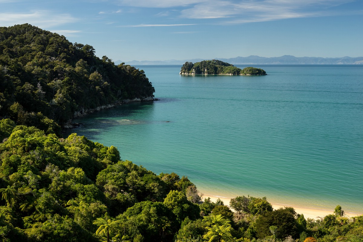
Abel Tasman is a coastal national park, famous for its beautiful beaches interrupted by forest-covered hills. The Abel Tasman Coast Track is a Great Walk connecting some of the most beautiful sections of this landscape. Due to its popularity you will meet many people along your way. Aqua taxis enable day trips in the area.
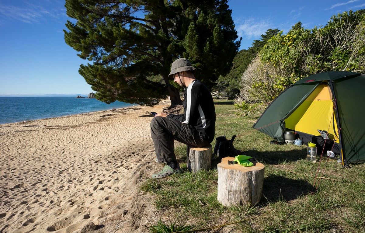
Of course, I was aware of this and thus decided to schedule my walk in May at the end of the season. In fact, it was no problem to get free slots at the campsites which need to be pre-booked as with other Great Walks. Many of those campsites are in really nice locations at beaches. And at least during my visit they were not overcrowded.
I took plenty of time since this was going to be more about relaxation than sports. I even planned to stay more than one night at Mutton Cove.
My route was the following:
Marahau – Te Pukatea Bay – Tonga Quarry – Mutton Cove (2 days) – Toteranui
The campsites I chose were among the most beautiful along the trail. The part north from Toteranui is less frequented as it is necessary to track back for boat transport.
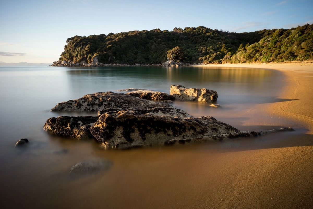
It was really an enjoyable time and I can highly recommend it. Fellow hikers told me, however, that during the main season the amount of visitors is magnitudes higher – especially on the sections that have direct boat connections.
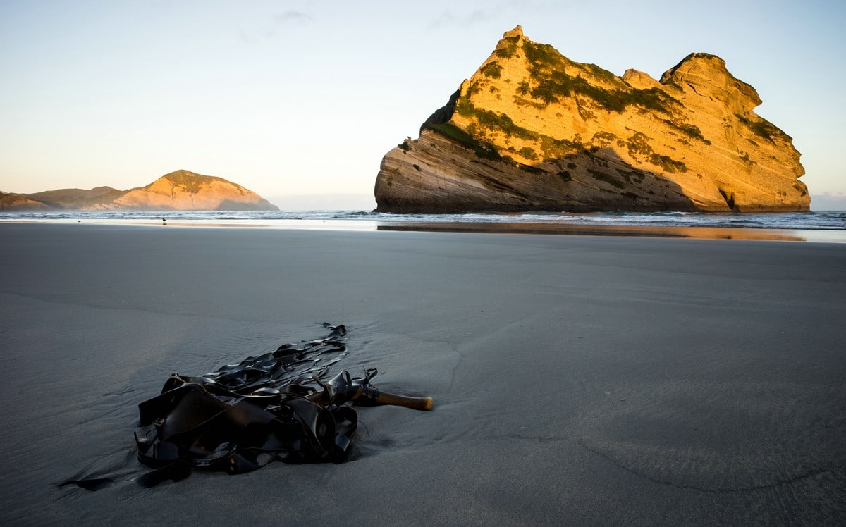
Wharariki Beach / The South Island’s Northernmost Point
After my visit to Abel Tasman I traveled to Wharariki Beach near the northernmost point of the South Island. The rock formations there are really iconic and worth the visit. Surprisingly, it was not as crowded as I would have expected.
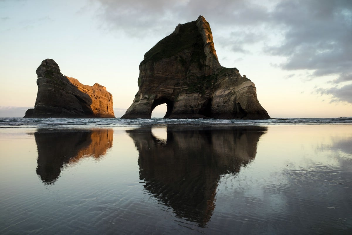
I visited the beach twice – in the evening and the following morning. Especially in the morning I was lucky to get really beautiful light. On the beach there is a tide pool where seals can be observed.
From the beach I walked further along the coast towards Cape Farewell lighthouse. The path winds up and down steeply through the coastal hills. The area is primarily used for grazing sheep.
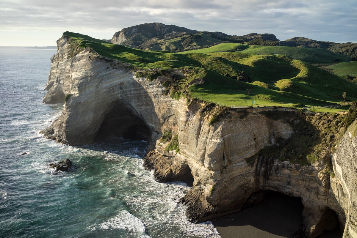
From the lighthouse it is possible to see Farewell Spit, which is protected and can only be visited by guided tours.
Two-Day Hike in Karuhangi National Park
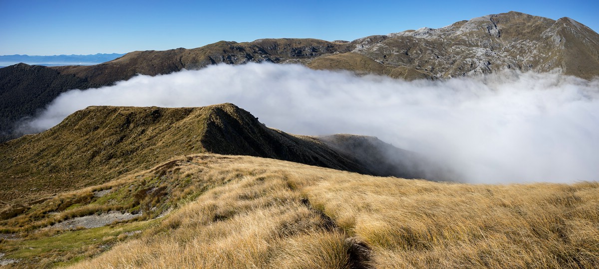
On the way back from the north I stopped near Motueka for a two-day hike in the Mount Arthur Tablelands. I started in the early afternoon and walked through forest to the Salisbury Lodge where I slept for the night. The hut is located in grassy landscape with views of the surrounding mountains.
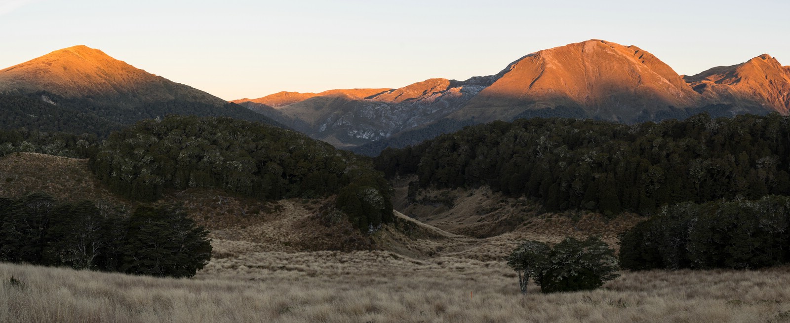
The next day I walked up to a ridge and followed it back towards the starting point. In the beginning it was foggy, but when I had reached a certain height, I was above the cloud level.
Mackenzie Country and Mount Cook
When I first traveled south from Christchurch in the beginning of my trip, I had decided to skip the Mackenzie Country with the Lakes Tekapo and Pukaki and leave them for later. Now, with some stops in-between my route led back to Christchurch and from there to Lake Tekapo.
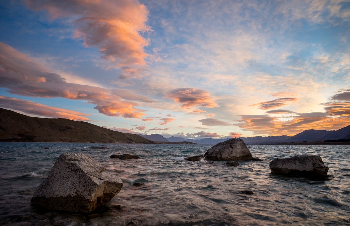
Lake Tekapo
Lake Tekapo, sourced by glacial melt water, is visited by many tourists on their way to Mt. Cook. In the correspondingly named village the Church of the Good Shepherd is a famous attraction and sure to be surrounded by tourists from the early morning to nightfall. It is directly located at the lake. Lake Tekapo is not anymore in its natural state but part of a hydro-power scheme. Lake Tekapo is connected by road with Lake Pukaki.

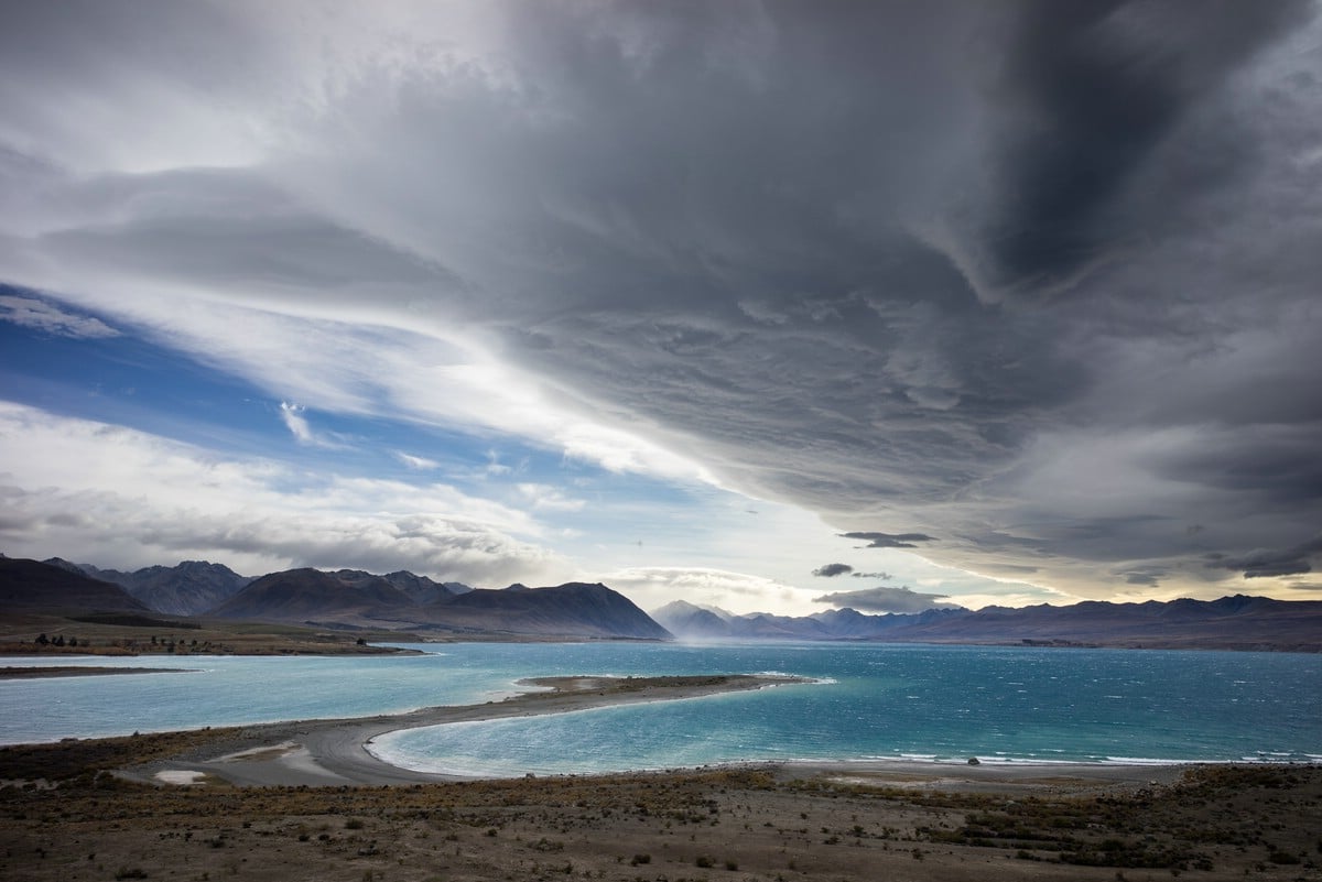
Lake Pukaki and Mount Cook National Park
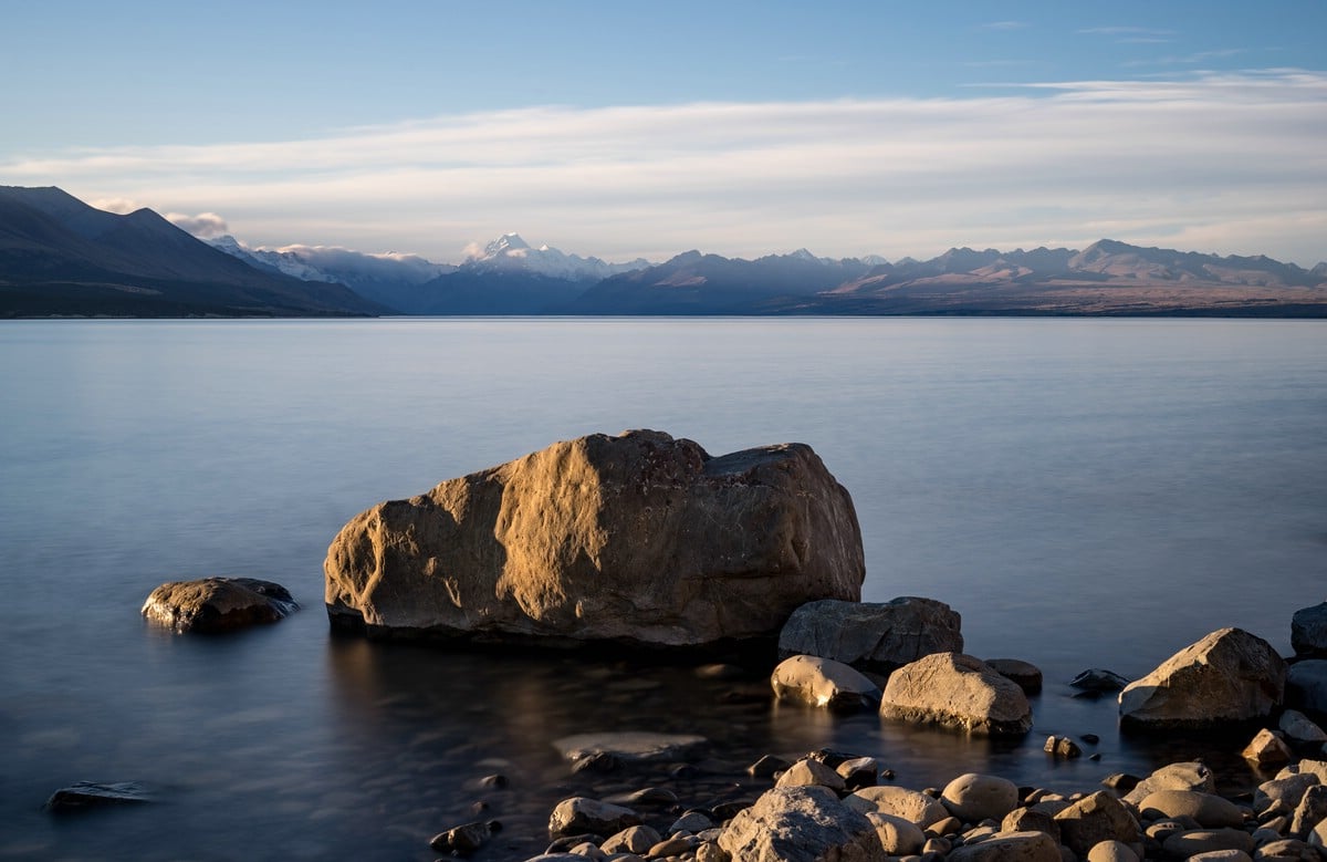
Also Lake Pukaki has been included in a hydro-power scheme. The corresponding infrastructure can be seen at its southern end. With its turquoise color (due to glacial sediment) it is still a beautiful sight. From its shore it is possible to see the summit of Aoraki/Mt. Cook during clear weather conditions.
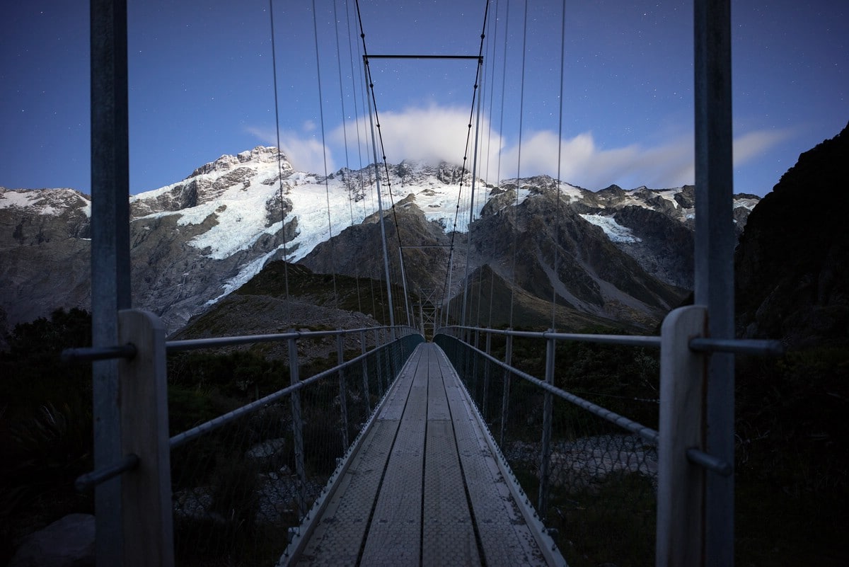
The road towards Mt. Cook National Park follows the western shore of the lake and finally reaches Mount Cook Village. When I arrived there it was raining heavily and the wind was almost a storm. Nonetheless, I pitched my tent at the local campsite – the weather forecast for the next day looked promising.
Indeed when I woke up in the early morning the sky was clear and stars were visible. I started my hike into Hooker Valley early and hoped for good light conditions for photography.
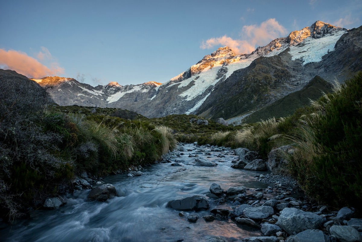
I knew that I would not make it to Hooker Lake (with views of Mt. Cook) before sunrise and so I slowed down and found a side-stream offering good views toward Mt. Sefton. Slowly the sun started illuminating the peaks.
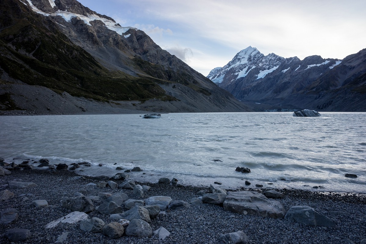
In fact, the morning light conditions at Hooker Lake are suboptimal as the sun is exactly behind Mt. Cook. The sight is impressive nevertheless:
During the afternoon I left the Mt. Cook area again; it would have been nice to invest more time into hiking here. Maybe next time ;-).
Arthur’s Pass
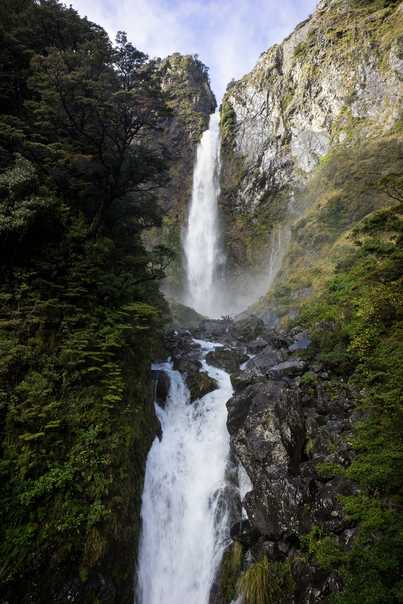
My last destination was Arthur’s Pass. After a lot of driving I finally arrived there and my first destination was Devil’s Punchbowl Falls, reachable on a short trail from the village.
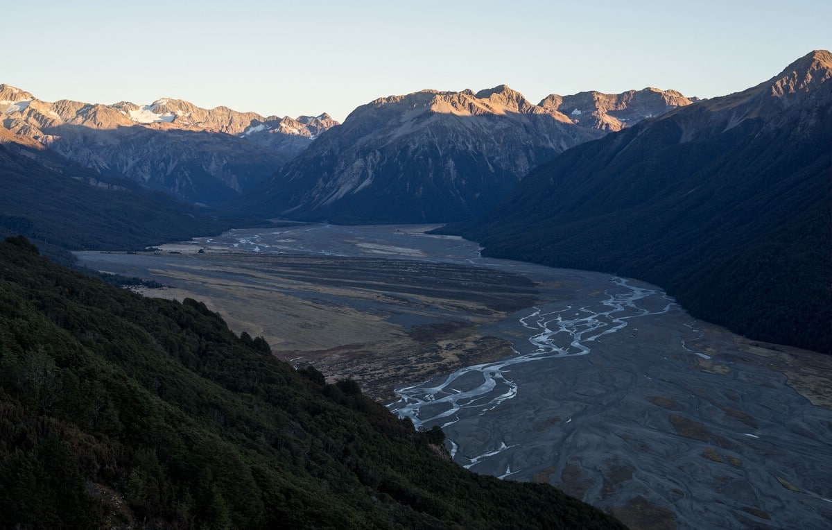
For the evening I had planned to walk to an old hut, high above the Waimakariri River Valley to spend the night there. They trail starts near the road bridge across the river. After an ascent through forest, the trail enters open grassland with magnificent views.
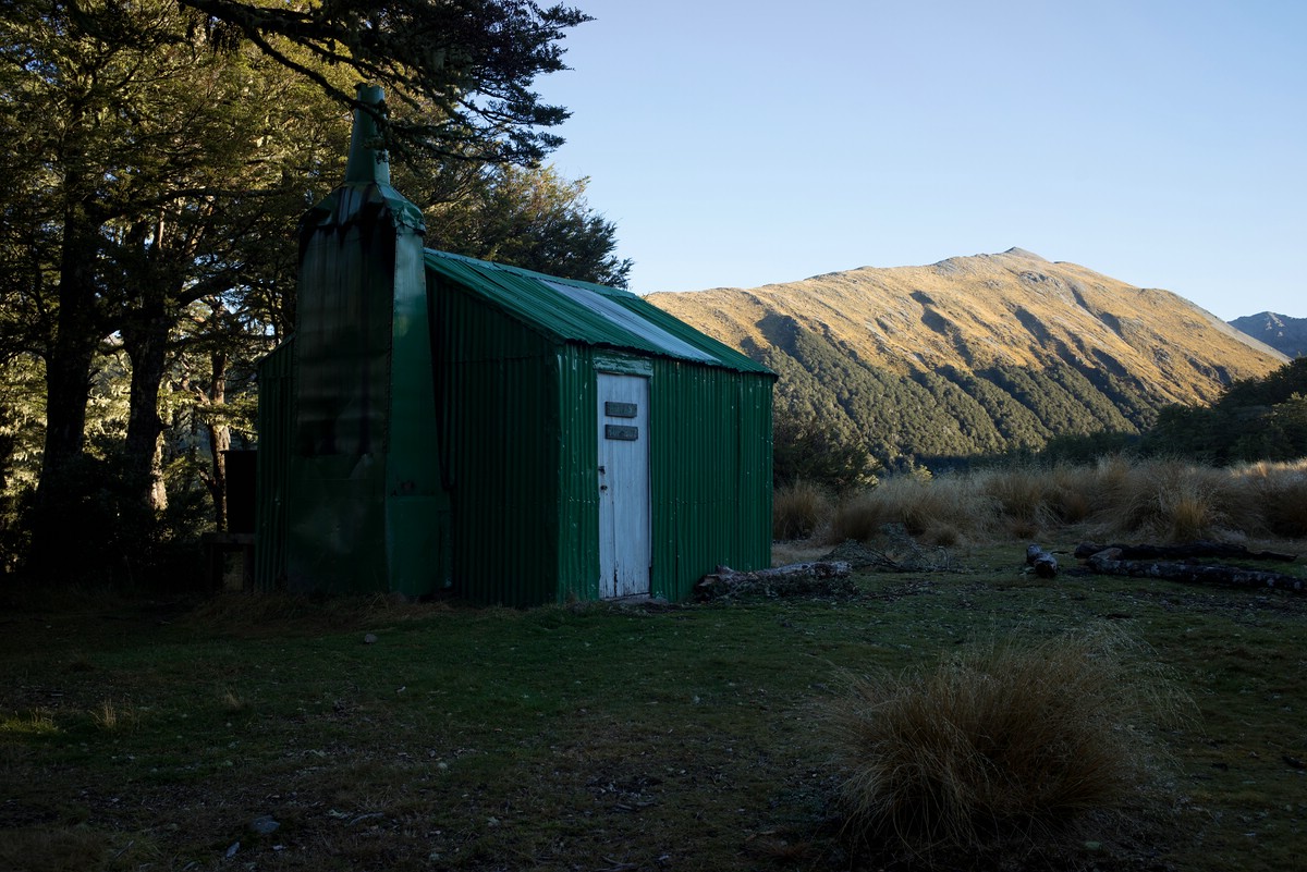
From the hut itself there is no view, however. In the morning I walked to the next viewpoint and waited for the sun to illuminate the surrounding mountains. This resulted in a nice contrast to the shadowed valley below.
Unfortunately, when I returned from the hike, a window of my car had been smashed and gear (backup camera, tent, clothes, etc.) had been stolen. I had all memory cards and other valuables with me, and so I considered myself lucky even in this moment.
The end
After I had contacted police I returned to Christchurch where I stayed one more night in a rented room. It had been great two months with a plethora of impressions but still there were so many things I would have liked to do but couldn’t due to time constraints. Maybe next time ;-)…